The dark gray days are upon us here in Vancouver Island, so getting out to explore is harder, but still critical for our sanity in the midst of the Covid-19 pandemic. So why not do a mid-November bike trip? Back in October — before the forecast was calling for snow — we decided to finally try the section of The Great Trail of Canada that goes from Shawnigan Lake to Cowichan Lake to Duncan. We combined the gravel off-road trail with country roads that are part of the Rotary Route to complete a 196 km loop from our home in Victoria. We took our time, completing the route in six days, two of which were “rest” days.
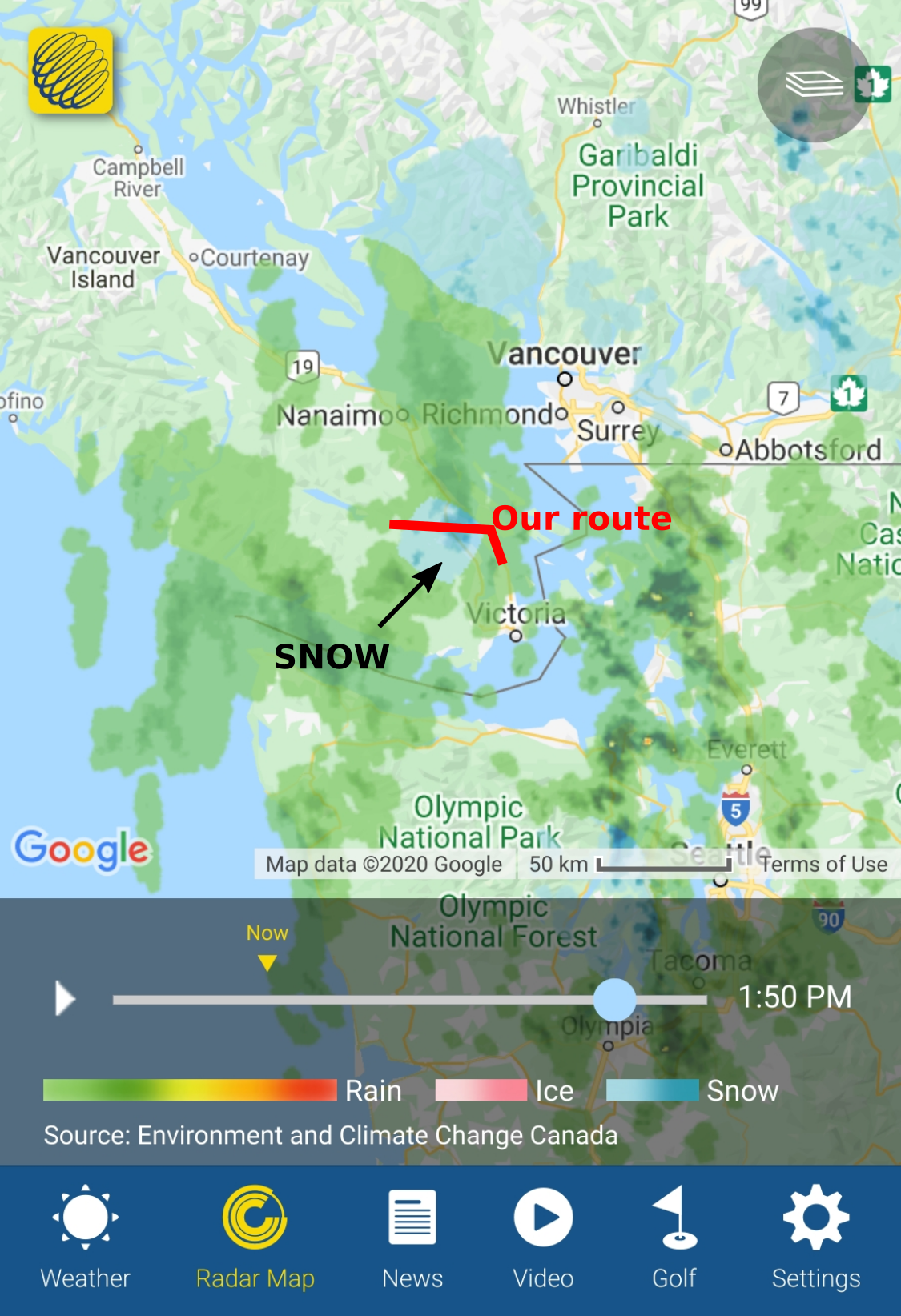
The trip wasn’t flawless — we had to change our planned route 16 hours before departing, our bodies and our bikes took a beating on the bumpy trails and we spent hours watching the radar trying to avoid the rain/snow — but it was all part of a great adventure! And as Adrien’s dad said, the fact that it was harder than expected was “un peu comme la vie, quoi” (i.e. “a bit like life”).
The full map, complete with pictures and route descriptions is available here. Keep reading for all the details of the route, or skip ahead to learn from our experience with cycling in November and our mechanical issues. We’ve also included a slideshow of pictures at the end.
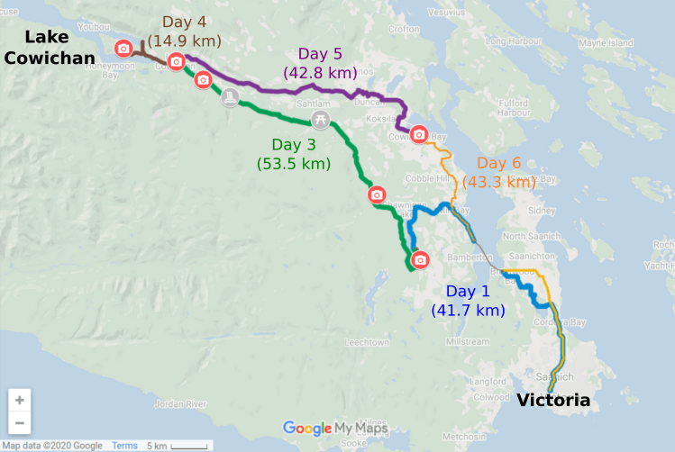
Victoria to Shawnigan Lake (Day 1)
To go from Victoria to Shawnigan Lake, we had two options:
- head west on the Galloping Goose, then north on the Sooke Hills Wilderness Trail (i.e. over the Malahat mountain)
- head north on the Lochside Trail, then west to catch the ferry at Brentwood Bay
We initially planned on option 1 because we liked the challenge of biking over the Malahat mountain and the route is entirely on trails. However, the day before our trip, Justine found out that a 100 m section of Sooke Hills Wilderness Trail (near Waugh Creek) was partly closed because of a landslide. Some reviews suggested we could get around the section, but we didn’t want to risk it, so we resorted to option 2.
The Lochside Trail is great to bike on and we’ve done it many times. To get to Brentwood Bay, we cut west just to the north of Elk/Beaver Lake and unintentionally took the scenic route near Bear Hill. It was beautiful, but hilly, and in hindsight it would have been easier to just stick to Oldfield Rd. as Google recommended.
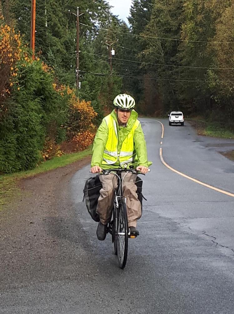
Once in Mill Bay, we crossed Highway 1 at the lights and took a right on Barry Road. This led us to a short connector trail to access Shawnigan Lake – Mill Bay Road. The trail had one steep hill that we had to walk our bikes up, but once on Shawnigan Lake – Mill Bay Road we had nice wide shoulders all the way into Shawnigan Lake. Then we turned south onto Shawnigan Lake Road, and the shoulders disappeared. Thankfully, the road wasn’t too busy in November, but this was one of our least favourite sections of the trip. The sun was in our eyes and visibility on the winding hilly road was low, but the cars that did pass us gave us lots of space. V was definitely on our mind during this short section.
Route maps available for Part 1 and Part 2.
Shawnigan Lake (Day 2)
Shawnigan Lake is both the lake and the community that surrounds it. We stayed in an AirBnB at the southern end of the lake, so accessing the village wasn’t convenient, particularly because the only access is the narrow Shawnigan Lake Road.
Shawnigan Lake to Cowichan Lake (Day 3)
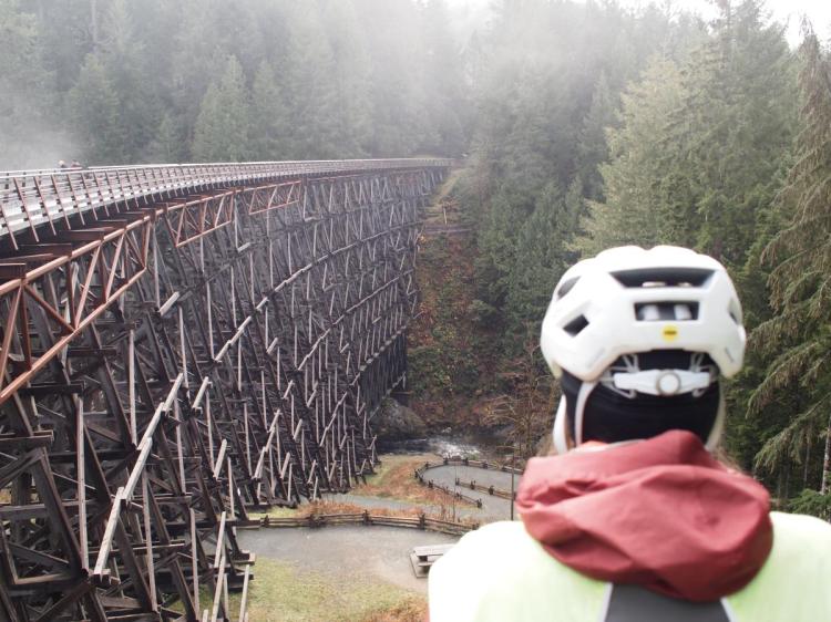
Shawnigan Lake and Cowichan Lake are connected by the Cowichan Valley Trail, a biking and walking trail that is part of The Great Trail of Canada. One of the main attractions on the route is the Kinsol Trestle, a 187-meter long wooden bridge that overlooks the Koksilah River.
Just to the west of the Kinsol Trestle, the Cowichan Valley Trail became very rough and bumpy. There were a lot of large rocks and muddy patches that would have been much easier to navigate with a mountain bike than our hybrid bikes. In total, the bumps lasted for about 30 km, so when we arrived at Lake Cowichan our bodies were tired and sore. We’ve since learned that this section of the trail is “maintained” by the Province of BC, unlike the nicer parts which are well-kept by the Cowichan Valley Regional District.
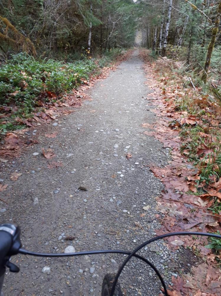
Despite the bumps, this section of the trail is beautiful. It passes through thick forest, over several trestles and is far from any large roads, so it is nice and quiet. We saw one large elk, but thankfully we didn’t need to use our bear spray!
Route map available here.
Cowichan Lake (Day 4)
The furthest point from home on our trip was Lake Cowichan, i.e. a small town on Cowichan Lake. So original!
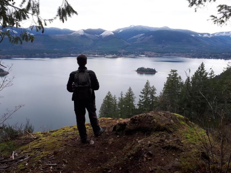
Cowichan Lake is a 30 km long lake surrounded by logging roads so, unfortunately, it wouldn’t be easy to bike around it. Instead, we biked a short distance to Bald Mountain and hiked 3/4 of the way to the summit. The forest on the mountain was previously logged, but is slowly growing back. The quasi absence of tall trees gives way to several great viewpoints on the lake and the residential developments under construction. The trail was very well maintained and had lots of switchbacks making it feel like a pretty easy climb, even with our tired legs. A highly recommended hike for anyone in the area.
Cowichan Lake to Duncan (Day 5 – Part 1)
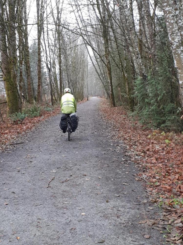
The part of the Cowichan Valley Trail that spans from Lake Cowichan to Duncan was definitely the best trail we biked on. It is quite wide, passes through a beautiful forest and feels flat, even through there was a 200m elevation change (mostly downhill for us). It was cold and rainy, so we only saw a couple other humans. We also saw two deer, that Adrien scared away with his bike bell.
Route map available here.
Duncan to Cowichan Bay (Day 5 – Part 2)
In Duncan, the Cowichan Valley Trail spits you out on Sherman Road. You then have to join Canada Avenue and bike south until you reach Beverly Street. We meandered through side streets and took a short section of the Friendship Trail, which was basically a gravel sidewalk.
After crossing Highway 1 at the traffic lights, we joined the Dyke Trail. The trail was great for cycling and we rode it until it ended at Tzouhalem Road. After crossing the busy road, we headed east along a nice wide shoulder. After about 200 m, we went through a roundabout where the traffic died off and we followed Tzouhalem Road until it joined Cowichan Bay Road that took us all the way into town.
Route map available here.
Cowichan Bay (Day 5)
Cowichan Bay is a quaint little harbour lined with coffee shops, restaurants and… a bakery! That’s obviously where we went first.
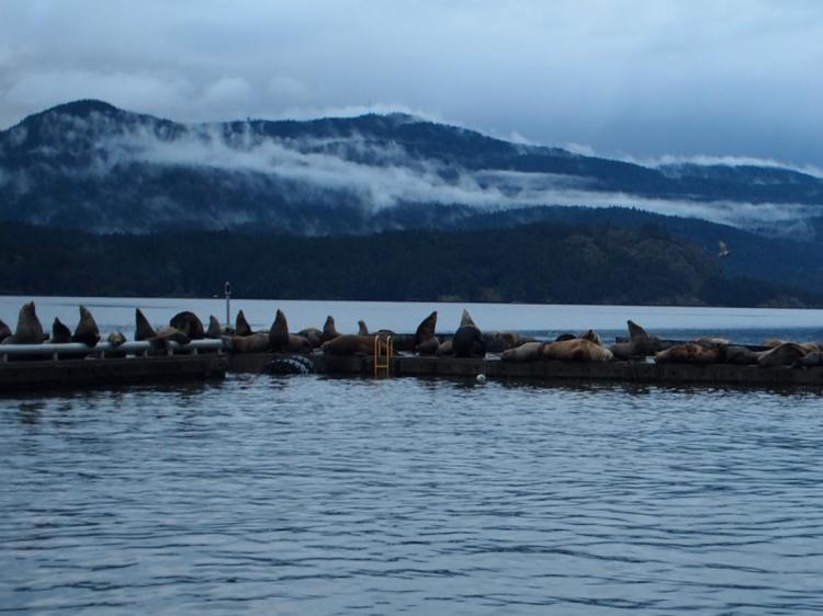
The attraction of Cowichan Bay were the sea lions from California that spend their winter on the wharf. They enjoy it quite loudly… so loudly that our hotel offered earplugs!
Cowichan Bay to Victoria (Day 6)
We took the Rotary Route from Cowichan Bay to Mill Bay. This led us through quiet country roads past vineyards and farmlands with views of Salt Spring Island. After climbing a long hill out of Cowichan Bay, we headed east on Cherry Point Road before joining up with Telegraph Road. It was a bit of a detour, but well worth the trip. Next time, we just need to make time to stop for some wine tastings!
When Telegraph Road ended, we turned right on Kilmalu Road but avoided the highway by immediately turning left towards Sweet Meadows Market. At the end of Church Way, we took a little path that goes parallel to the highway for about 100 m before spitting you out on Lashburn Road. We were skeptical about this section since we planned it based on Google Street View, but it was easy to navigate and find! Lashburn Road then took us into Mill Bay where we grabbed a coffee before making our way south to the ferry terminal.
On the other side of Saanich Inlet, from the Brentwood Bay ferry terminal, we immediately turned left on Peden Lane to reach Stellys Cross Road. It has a nice wide shoulder on the south side and little traffic, so it is a good way to cross the peninsula when heading east. At the end of the road, we headed south on East Saanich Road then turned left on Island View Road to join the Lochside Trail, back to Victoria.
Route maps available for Part 1 and Part 2.
Biking in November
For this trip, Justine turned into a weather specialist, giving Adrien hourly updates on the oncoming rain, wind and even snow thanks to predictions and forecasts from Environment Canada, the Weather Network and Windy. Plans changed by the minute as we took advantage of any dry gap and tried to avoid the worst of the storms. In the end, we managed the weather pretty well, having only one ride in the rain and making it home before the 60 km/hr wind warning took effect.
More challenging was the temperature. It was between 1 and 10 degrees Celsius every day, so we were cold when we stopped, but sweaty when we had to climb hills because we had so many layers on.
We are not experts in proper clothing, but we had lots of layers that:
- we could easily put on and off
- didn’t take much room in our saddlebags
- dried quickly
- are colourful and flashy enough to be seen from far by drivers
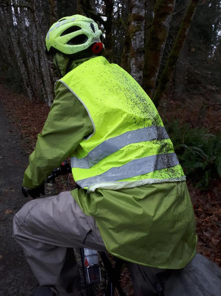
Adrien’s green poncho and vest combination served all these purposes in one! Although, it wasn’t overly aerodynamic.
Mechanical Issues
The heaviest gear that we brought on our trip was the bike tools bag. Still, we managed to forget the screwdriver!
The rough parts of the Cowichan Valley Trail took a toll on our city bikes and, on the morning we left Lake Cowichan, Justine realised that the screw was missing that attaches the rear rack to her bike. Thankfully the hardware store was open and they had the right size screw to quickly fix the problem (and the screwdriver to go with it).
The second technical problem happened 5 km before arriving home, when Adrien had a flat tire. Luckily, we were able to use a bike pump that is on the side of the Galloping Goose to pump up the tire enough to finish the ride home.
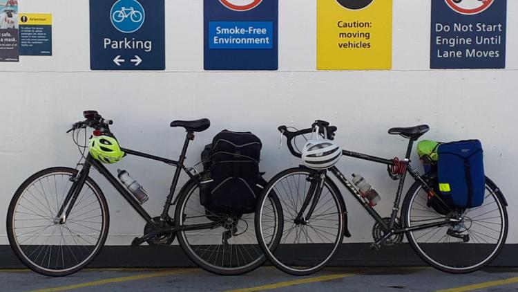
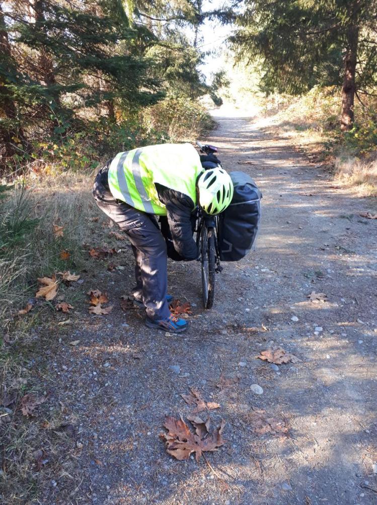
And of course, as with all of our bike trips, there is the issue of Adrien’s cheap saddle bags. Essentially they fall off the rack after every bump, which occurs a lot during these off-road trips. After a frustrating first day, he rigged up a better bungie cord system to get us through the trip. But, a new saddle bag was purchased as soon as we arrived home!
What to eat
Because we didn’t want to eat out every day, and due to Covid-19 restrictions, we brought most of our food with us. We made one trip to a grocery store and treated ourselves to dinner in Lake Cowichan, but we lugged the following in our saddle bags:
- a frozen homemade curry
- frozen sausages and buns for a barbecue
- ingredients for a quinoa, black beans and yams stew
- ingredients for vegetable wraps
For breakfast, we ate oats and fruits and for lunch we had our usual saucisson and cheese. We stopped most often for coffee, of course.
Picture Slideshow
The pictures don’t do justice to how beautiful the forest was, how bumpy some of the trails were or how happy we were to be dodging the rain, but they still show a few highlights from the trip.
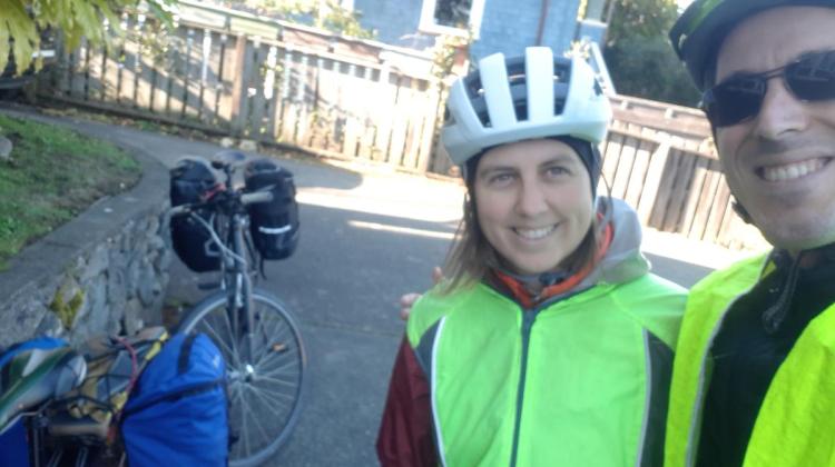
Clad in bright yellow and ready to go! A great sunny start to the trip. Bikes loaded on the Mill Bay ferry. Travelling by bike on BC Ferries is very convenient. 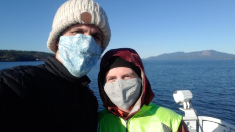
Traveling during Covid-19! The masks are important defense against the virus but also helped keep us warm on this cold ferry crossing! Fixing the saddle bag after hitting a bump. This is a regular occurrence on our bike trips. A new bag was purchased as soon as we got home. 
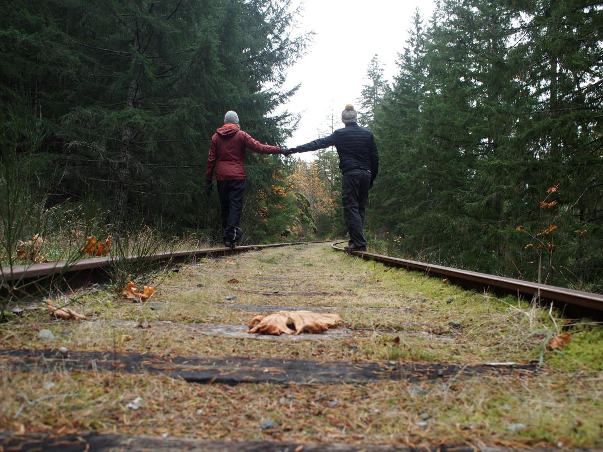
A nice flat walk on a rest day. 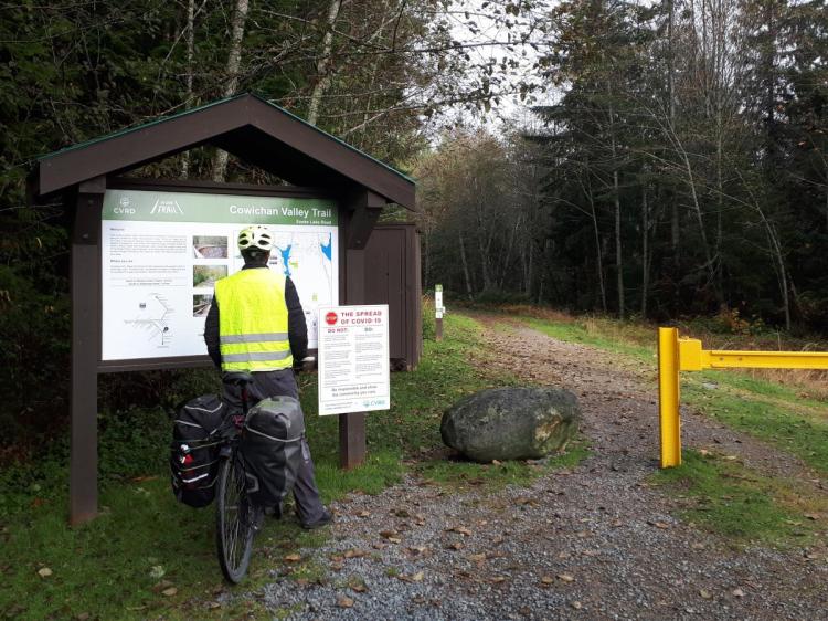
Checking out the map of the Cowichan Valley Trail and taking a break after a big climb. Checking out the view of the impressive Kinsol Trestle. 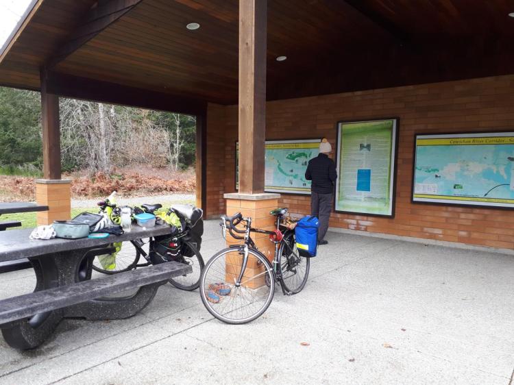
Glenora Park was a great spot for a quick lunch. Picnic tables, bathrooms and a history lesson! 
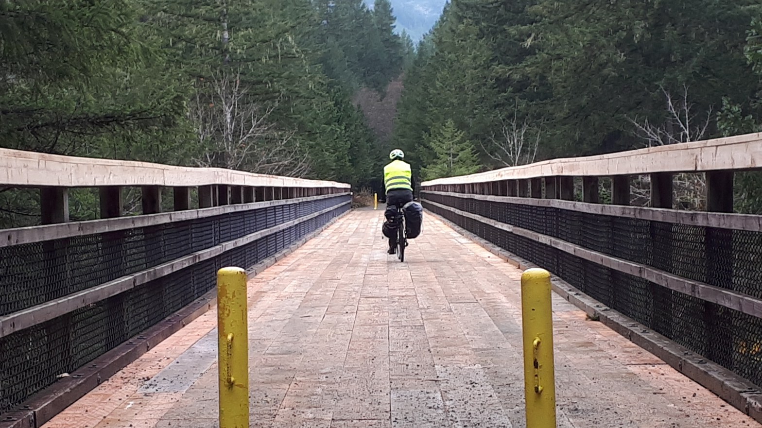
Biking across the Mile 70 Trestle on the way from Shawnigan Lake to Lake Cowichan. 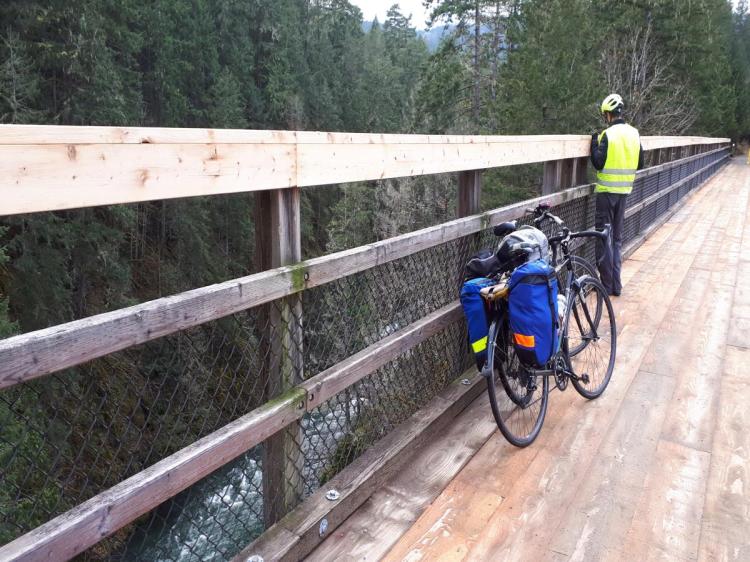
Checking out the view at the Mile 70 Trestle, and taking a break from all the brain rattling due to the bumpy trail. South Section of the Trail to Lake Cowichan. It is hard to tell, but it was very bumpy! All the rocks of different sizes had our brains shaking a bit… 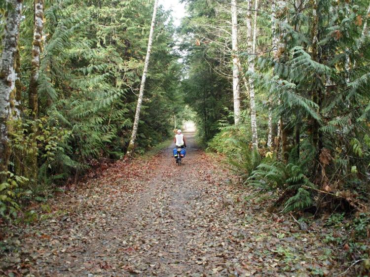
Despite being a rough ride, it was still beautiful! 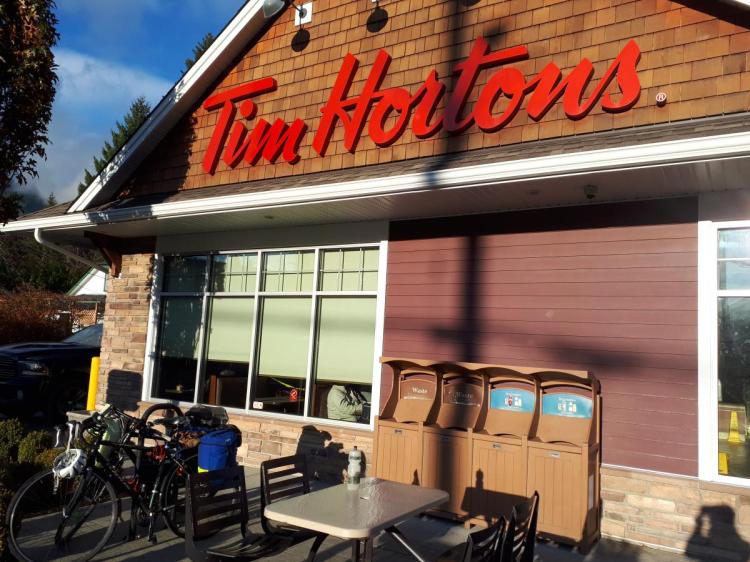
Canadian Pit Stop. With Covid-19 restrictions, smaller cafes were closed, so two stops at Timmies were part of the trip. Warm drinks, TimBits and a dry space to sit! View of Cowichan Lake from a look off on Bald Mountain. One of the nicest hikes we’ve done on Vancouver Island. Cowichan Valley Trail (North Section). Beautiful conditions, even in the rain. 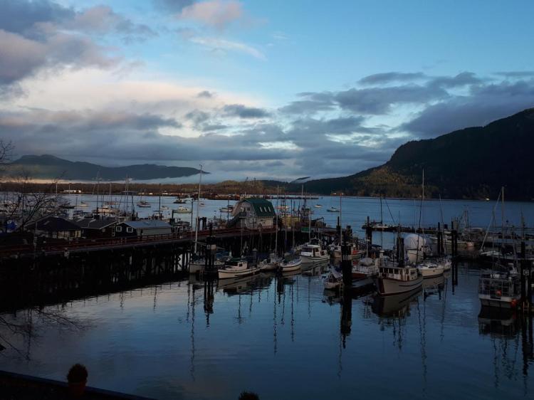
Finally a break in the rain to catch the sun rise over Cowichan Bay. Sea lions from California spend their winters in Cowichan Bay. They were cute, but noisy! Even with earplugs, they kept Justine awake!! 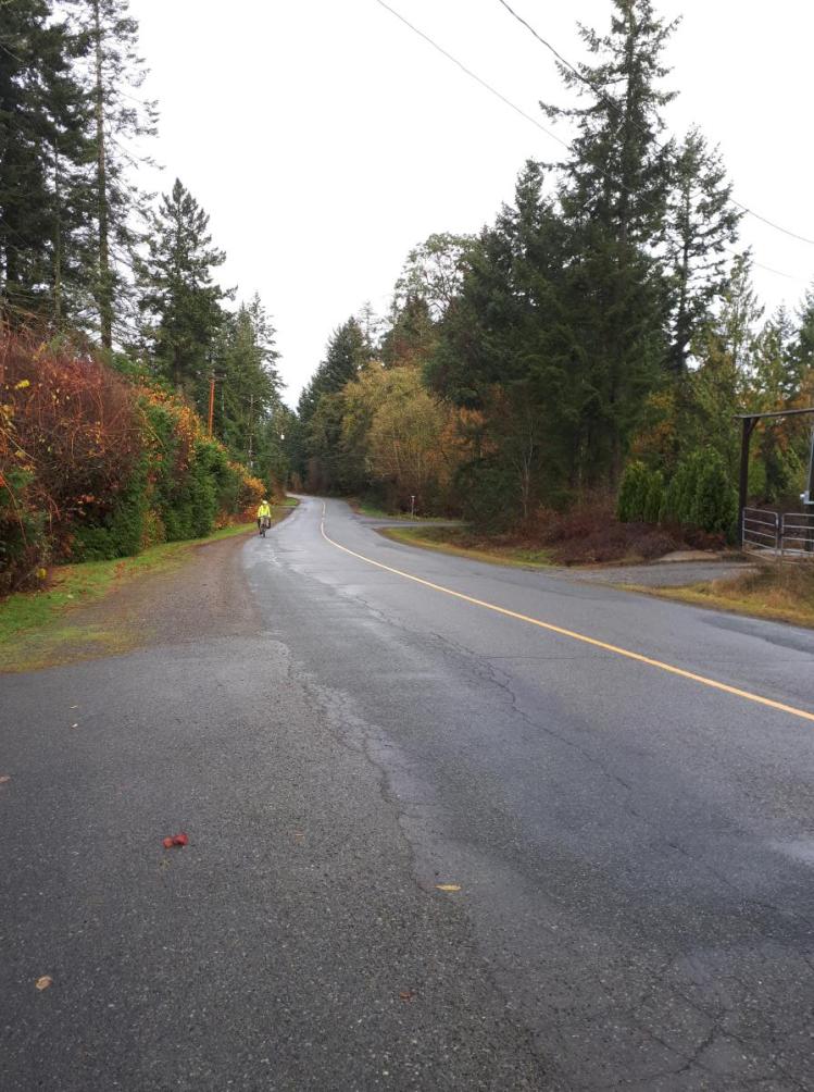
Climbing a hill on the Rotary Route. There is no dedicated bike path, but the quiet country roads pass through vineyards and farmland. Making it to the top of the hill along the Rotary Route. 
Homeward bound. Reflecting on the trip, checking out the view, and trying to keep warm on the ferry.

Wow – quite a journey – Mom would be very proud of both of you as am I.
LikeLiked by 1 person