The Rum Runners Trail is a 119 km multi-use trail from Halifax to Lunenburg. It consists of seven connected segments including:
- Chain of Lakes Trail (COLT): 7km paved section from Halifax to Beechville
- BLT Trail: 13 km gravel section from Beechville to Hubley
- St. Margarets Bay Trail: 32 km gravel section from Hubley to Hubbards
- Aspotogan Trail: 10 km gravel section from Hubbards to East River
- Chester Connector: 33 km gravel section from East River to Martins River
- Dynamite Trail: 10 km gravel section from Martins River to Mahone Bay
- Bay to Bay Trail: 10 km section from Mahone Bay to Lunenburg
As of Sep 4th 2022, we’ve completed the first six segments and describe our experiences below and in the interactive map. We include an explanation of how to safely get to the trail from Halifax’s north end.
We also make some recommendations for day trips and worthwhile detours. Our experience doing a cycle touring trip along this route is also summarized.
Day Trips
Typically we do out-and-back day trips along short sections of the trail. Our top recommendations would be:
Halifax to Cranberry Lake
15 km each way
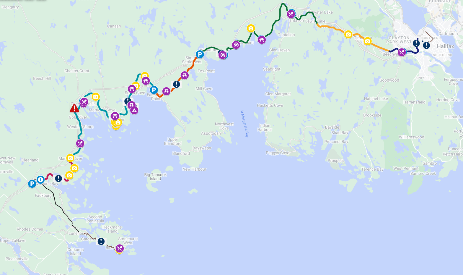
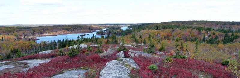
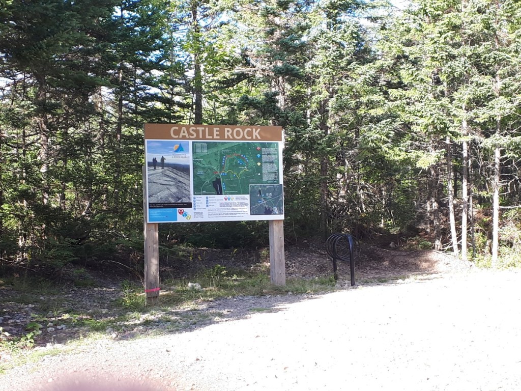
A great spot for a picnic and a swim with some flat rocks that lead directly into the water. There are also a couple benches to enjoy the view. This spot is also near the trailhead for the Bluff Wilderness Hiking Trail, which is a great hike! Bike racks are located at the trail head.
Halifax to the Bike and Bean
30 km each way
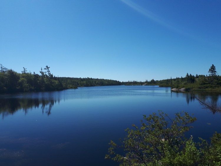
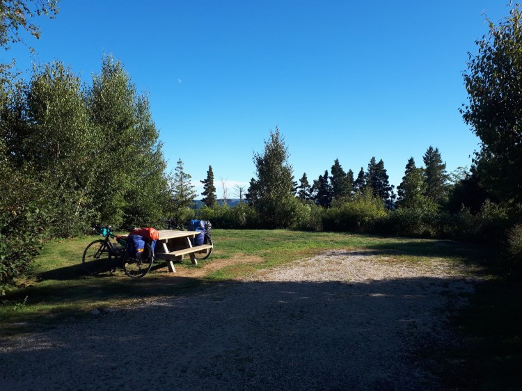
The Bike and Bean is a joint cafe and bike shop located right on the trail in Upper Tantallion. It is always a busy spot! And if coffee isn’t your thing, Cavacchi’s Meats sells ice cream next door!
Bike and Bean to Queensland Beach
20 km each way
If you have a car, the Bike and Bean is a great spot to start and end a ride. In particular the segment to Queensland Beach offers the best views of the entire trail as it follows the coastline of St. Margarets Bay.
Worthwhile Detours
We’ve also discovered some great side trips off the Rum Runners trail to explore several areas of the south shore. We’ve marked the routes and access points on the map.
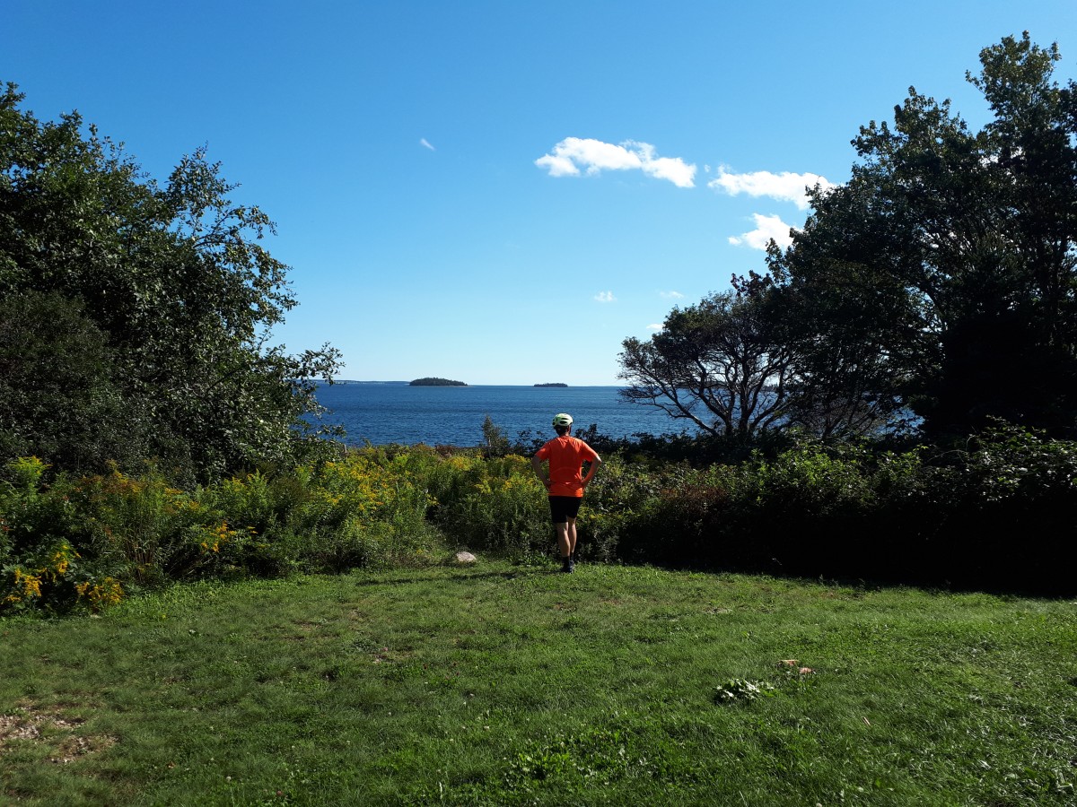
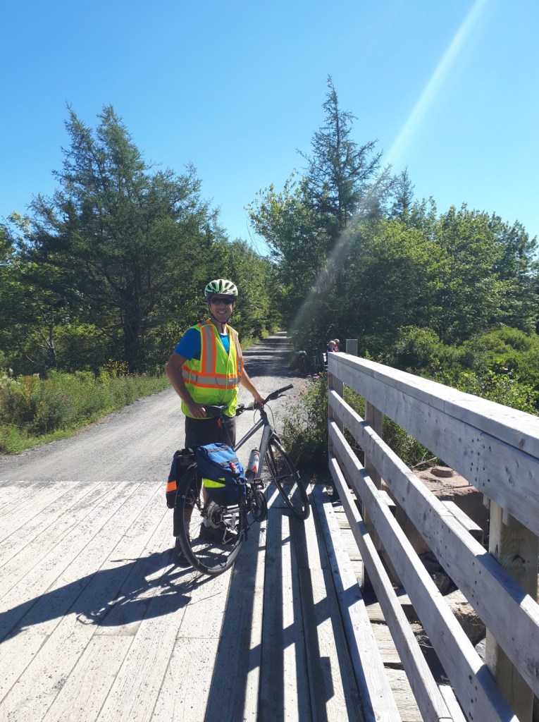
Cycle Touring Trip
On Sep 3-4, 2022, we did a cycle touring trip from Mahone Bay to Halifax in 2 days with a stopover at Graves Island. The total distance was 120km with 40km on day 1 and 80km on day 2. It was tough, but doable, for us average adventurers.
We would love to see cycle touring along this route become a more accessible option in the future. Currently, the lack of a shuttle and limited affordable accommodation near the trail make it a logistical challenge.
Trail Sections
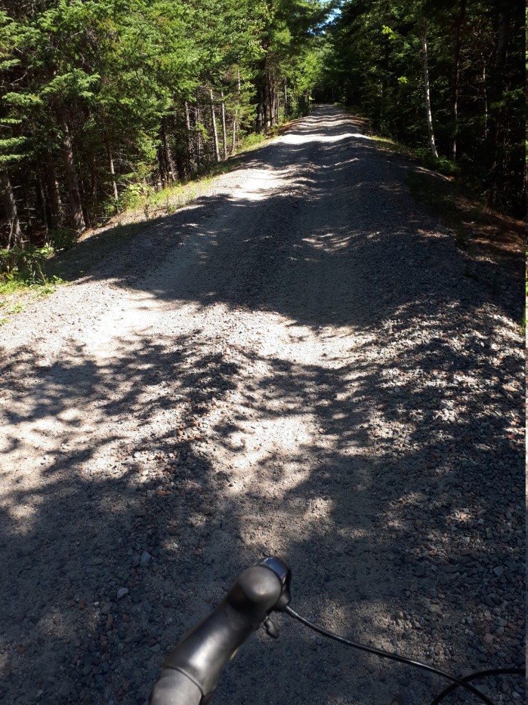
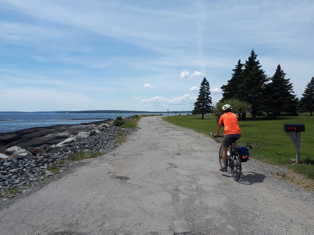
In general, the trail is in good condition, but it gradually deteriorates the further you get from Halifax. We have hybrid style city bikes and have had no major issues navigating the trail, but sometimes it is bumpy or sandy, particularly from Hubbards to Mahone Bay.
Also, be aware that this is a true mutli-use trail so there will be other users, including walkers, ATVers and the occasional horseback rider! Use your bell and yield when necessary.
In our map, we highlight all the important points of interest for exploring the trail, including picnic areas, restaurants, parking areas, and of course, washrooms! We’ve recently discovered that Halifax trails also has a simliar, albeit slightly more comprehensive, guide and map.
Chain of Lakes Trail (COLT)
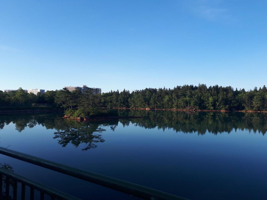
The 7km section from Halifax to Beechville is known as the Chain of Lakes Trail. It is paved and passes several lakes that offer good views. The trail is a gradual uphill from the start to about the 5km mark which makes leaving the city a lot harder than coming back. There are also several large road crossings through Bayers Lake that can be busy during weekdays.
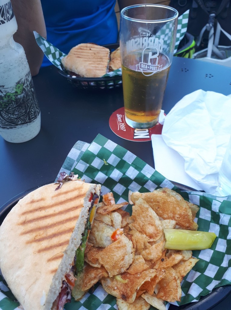
A stop at The 5k Cafe is highly recommended. They offer great sandwiches, ice cream and beer! We tend to refuel there often.
BLT Trail
The BLT (Beechville-Lakeview-Timberlea) Trail meets the COLT trail at Lakeside Park Dr and goes for 13 km to Hubley. It consists of packed crusher dust with one paved section in Timberlea. There are several road crossing where you have to yield to cars, but the trail is in great condition.
Highlights along this section of the trail include Cranberry Lake and the Bluff Wilderness Area.
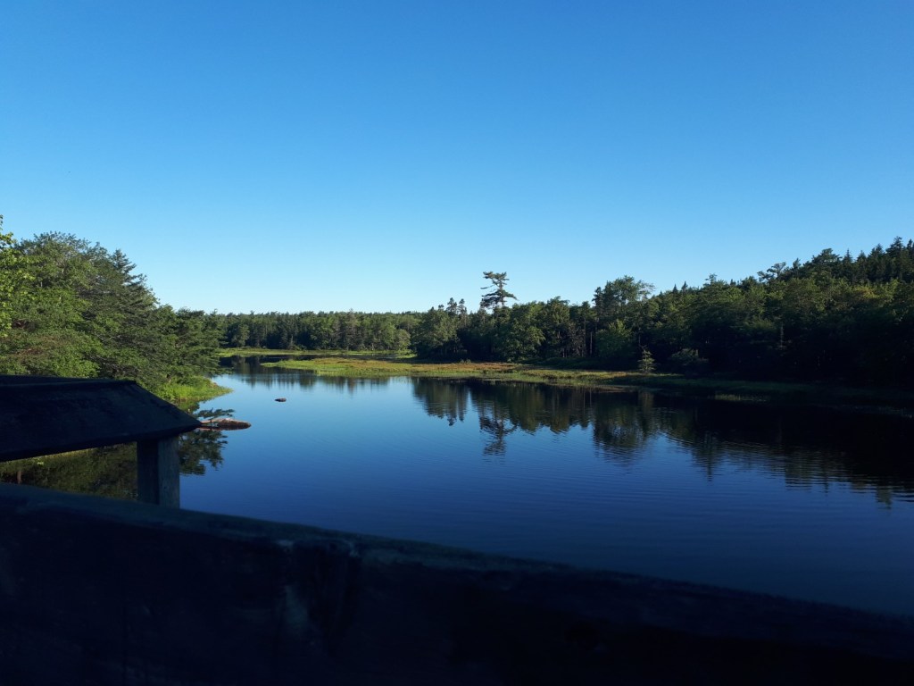
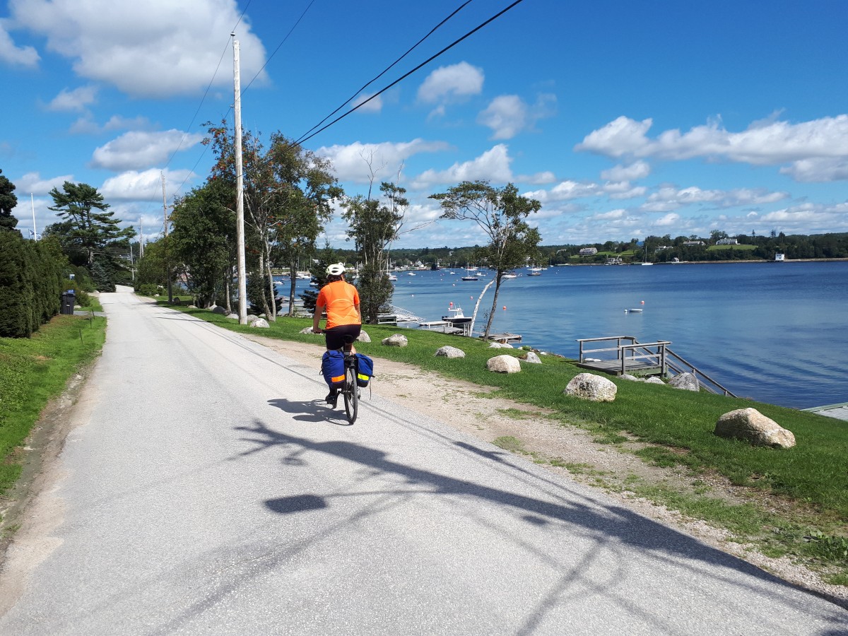
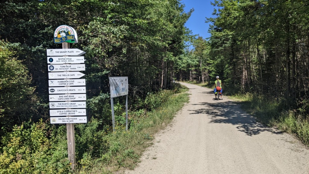
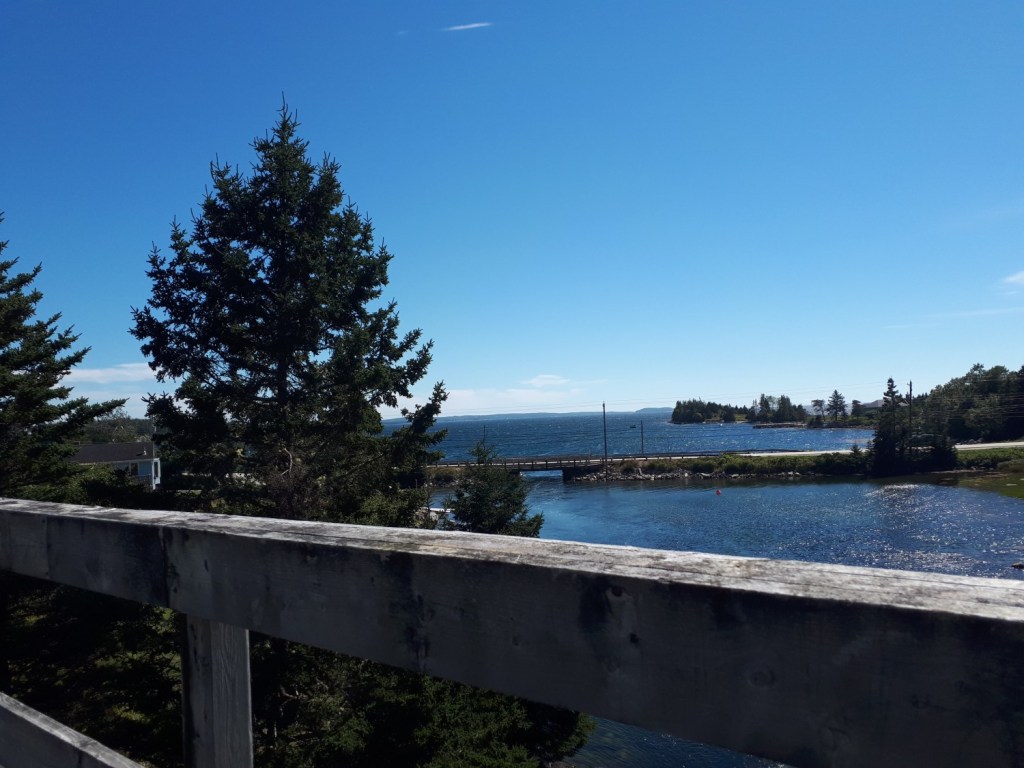
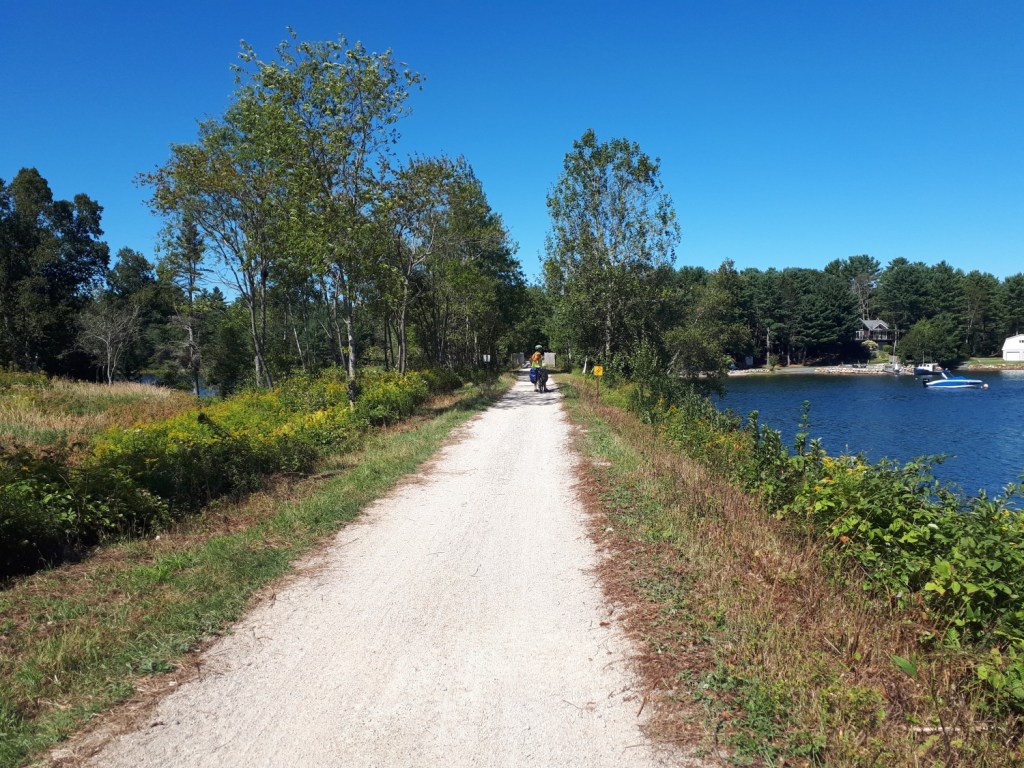
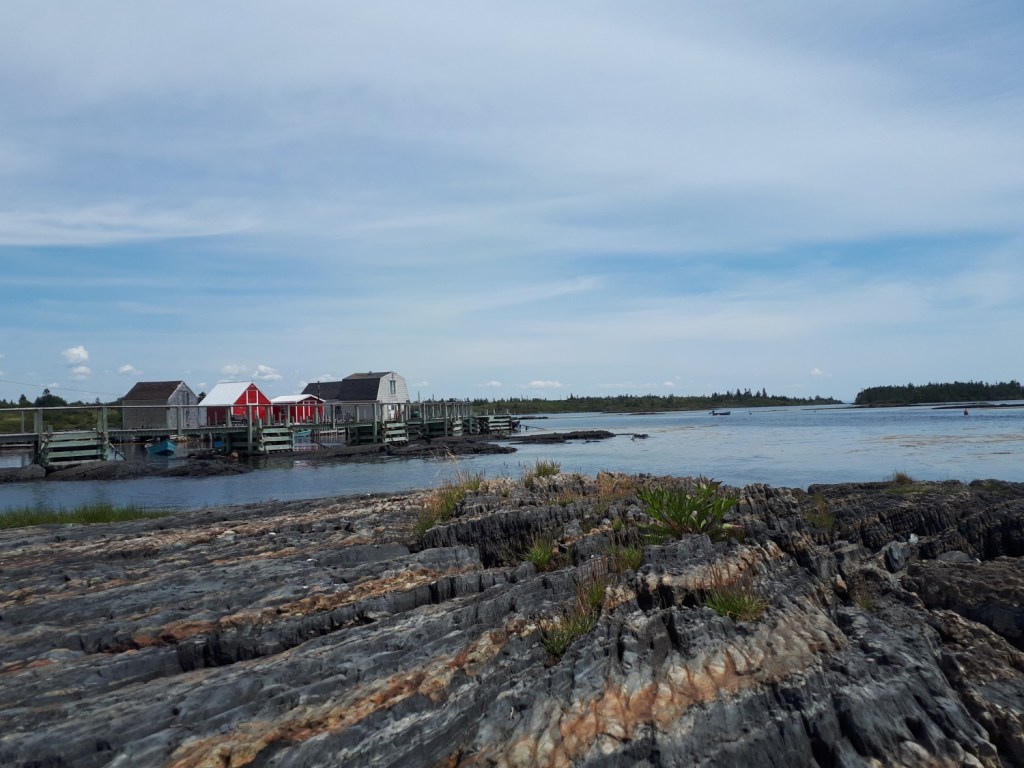
St Margarets Bay Trail
The St Margarets Bay Trail is 32 km in length going from Hubley to Hubbards. It is a beautiful section of the trail with many ocean views. The trail consists entirely of packed crusher dust and is in great condition as of Sep 3, 2022 after potholes were filled earlier this summer.
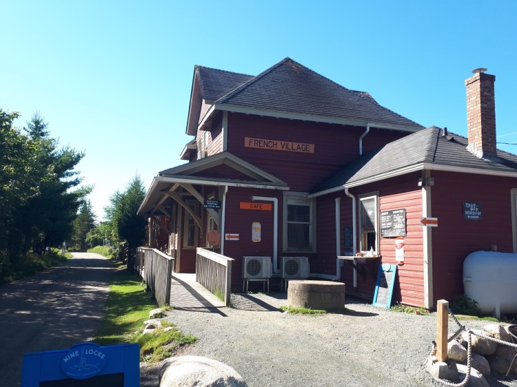
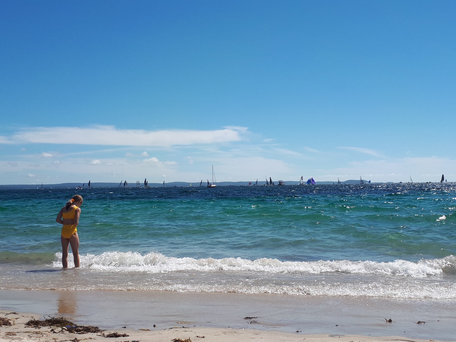
Highlights include the Bike and Bean and Cavacchi’s Meats. There are also two great beach options — Queensland Beach and Cleveland Beach. Both are short detours from the trail, but there is no signage, so pay attention to the map. Cleveland Beach is a little more accessible in our opinion.
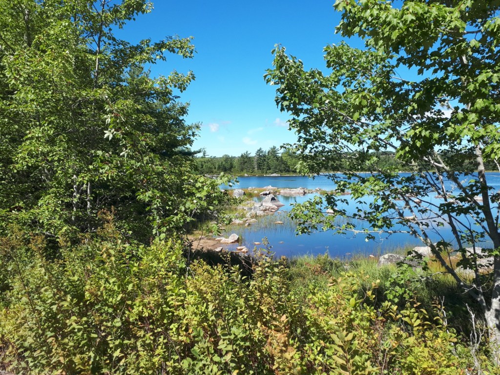
Aspotogan Trail
The Aspotogan Trail is a 10km trail that transects the Aspotogan Peninsula. It is mostly forested with two picnic tables that offer nice views — one of which provides access to Noonan Lake.
The trail condition is mediocre. There are lots of potholes, some rocky sections and some sandy areas. So it is a bit rough going, but definitely passable for most riders.
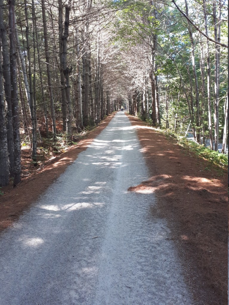
Chester Connector
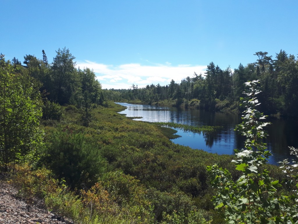
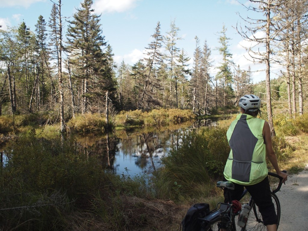
The Chester Connector is a 33km section of the trail from East River to Martins River. The trail is mostly forested passing by lakes, bogs and rivers.
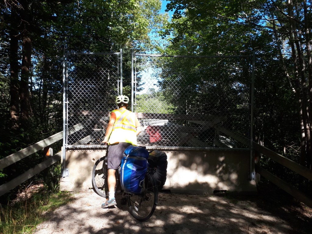
Similar to the Aspotogan Trail, this section is littered with potholes and loose gravel, but is easily passable (but bumpy) for most riders. WARNING: As of Sep 3, 2022, the bridge at Gold River is closed. There is a small sign on a cement barricade, but we didn’t see it. The detour is short but not marked so we had to rely on Google to navigate the best route.
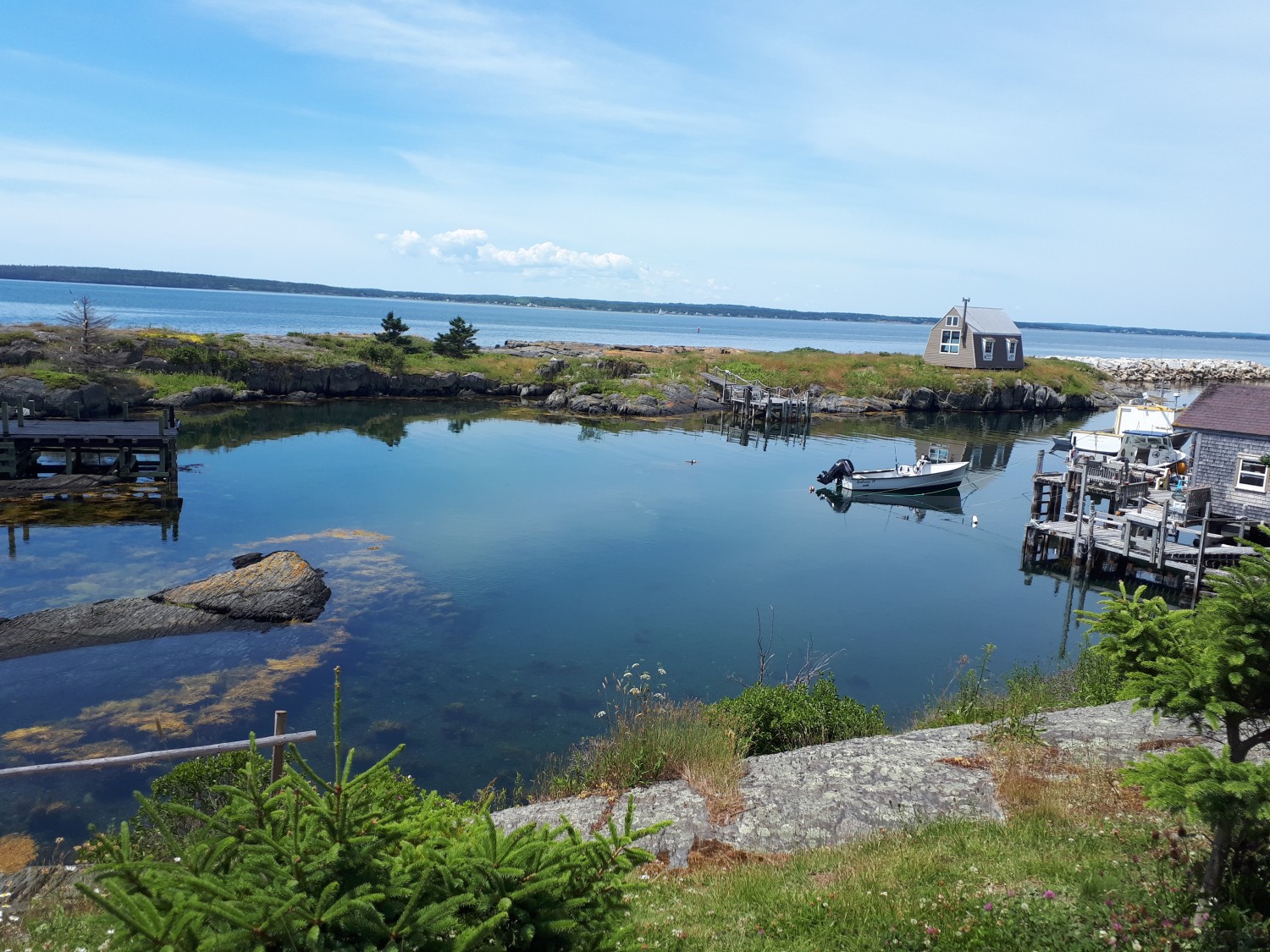
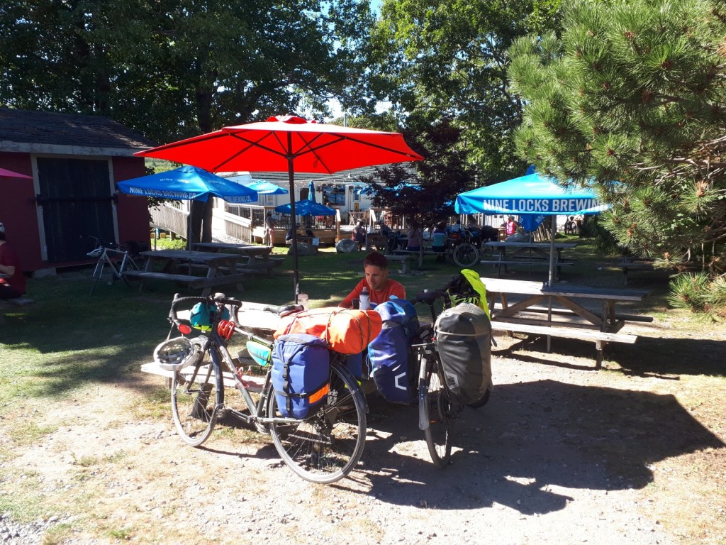
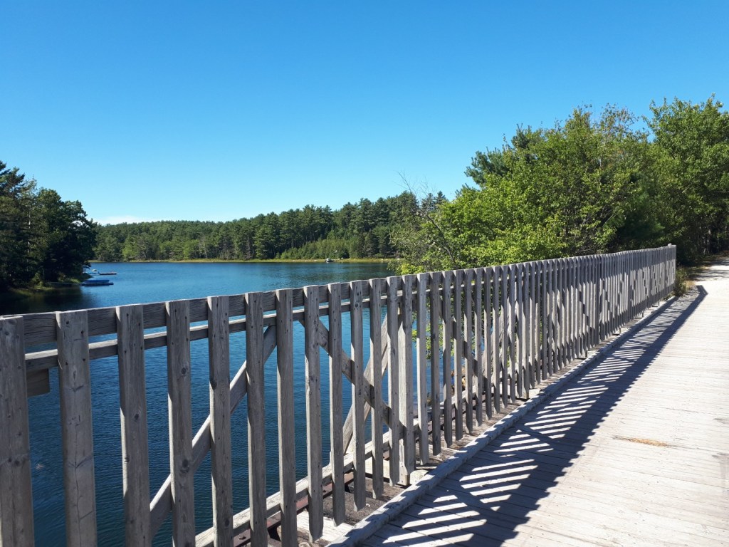
Great detours from this trail include Graves Island Provincial Park and the town of Chester.
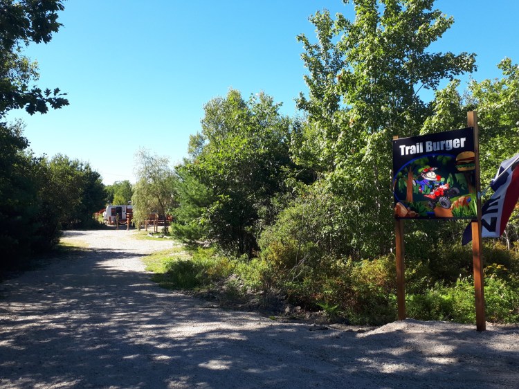
Near Martins Point we came across the Trail Burger, which turned out to be a great spot for ice cream. They also had a lovely garden to enjoy it in. It would be nice it they added a cyclist to their sign though!
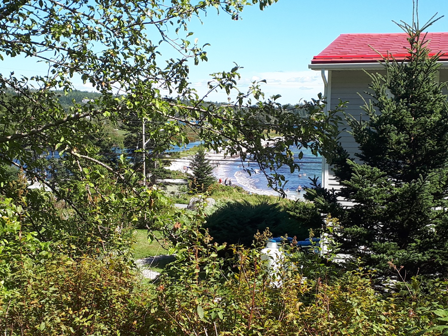
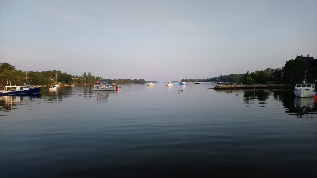
Dynamite Trail
The Dynamite Trail is a 10 km section from Martins River to Mahone Bay. The trail offers ocean views at The Narrows, but otherwise passes through forested areas with plenty of birch trees.
This trail was sandy and slippery! It had been recently graded, but the gravel was not compressed enough, making it hard to navigate in parts, especially with several kilograms of gear on our bikes. It was passable, but was tougher than the other parts.
Adventure Trail (Add-On)
The Adventure Trail is a 15km trail from Mahone Bay to Bridgewater. We covered the first section to get to Blockhouse where we started our cycle touring trip. It was by far the worst section of the trail and we heard from another rider that it is almost impassable in some sections past Blockhouse. Hopefully they get the crusher dust compressed and this trail improves in the future.
Lunenburg to Blue Rocks (Add-On)
This route is not officially part of the Rum Runners Trail but it is a nice 7km detour from Lunenburg.
From downtown we rode to Sawpit Rd. where we headed east on the Bay to Bay Trail. It looked like an old road with tire tracks and grass in the middle, but was okay by bike on a dry summer day. When the trail ended, we continued east along Blue Rocks Rd. Most of this road has a medium sized shoulder, and it wasn’t too busy, but there were definitely a couple cars that passed too closely. When we reached the church at the end of Blue Rocks Rd, we took a right onto The Ln and followed The Point Rd. until it ended.
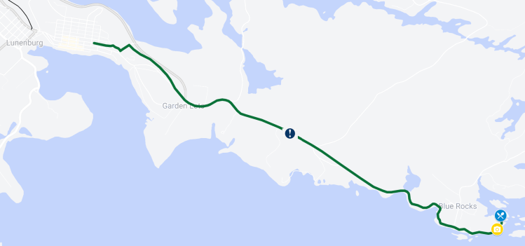
The last part of the ride provided great views of Lunenburg Bay and the many islands. There is even a tiny general store called The Point General that has souvenirs and tasty treats. Just after arriving here a large cycling group with Backroads Adventure arrived so we decided to have our own picnic on the rocks instead of waiting in line.
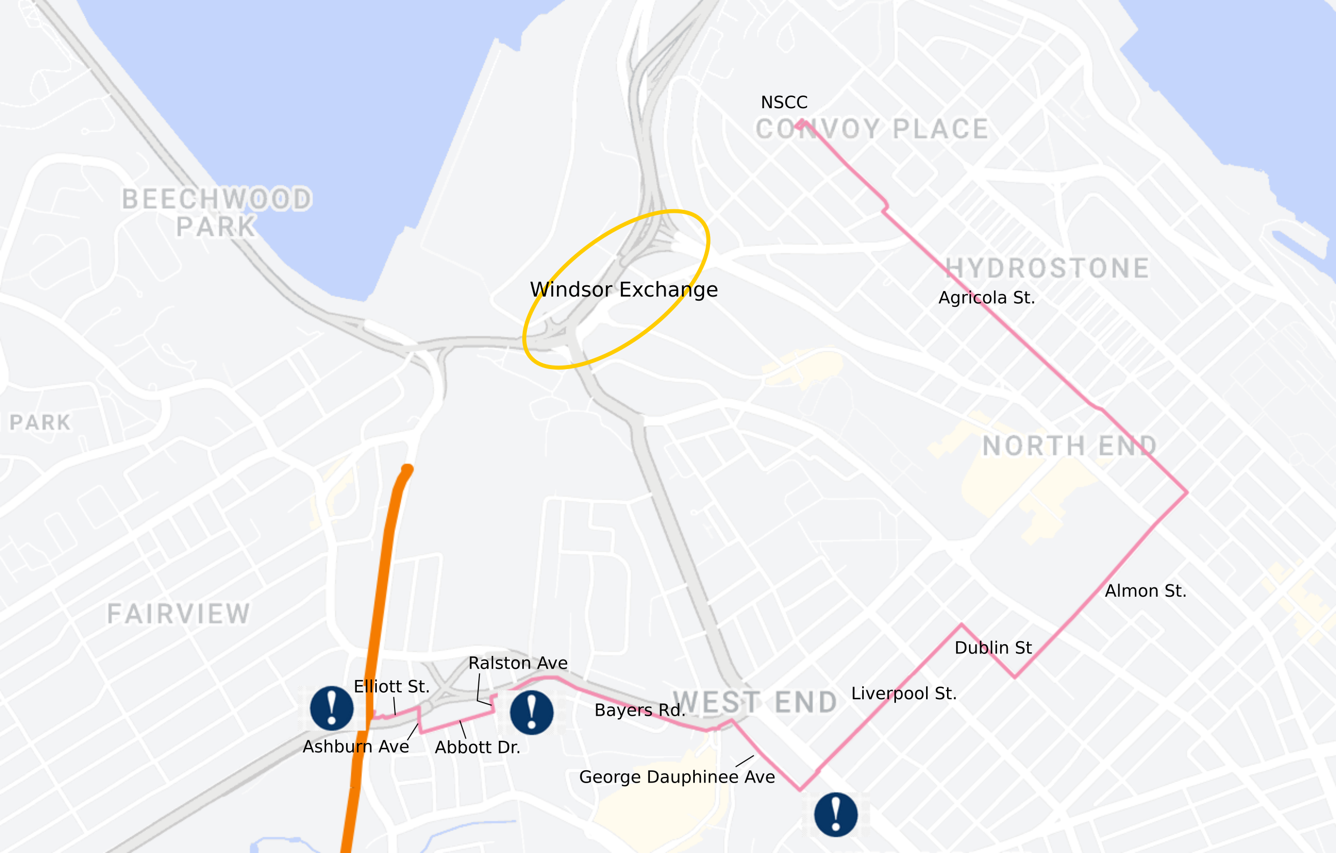
Getting to the trail from the Halifax’s North End
Getting to the trail is often the hardest and most stressful part. The Windsor Exchange would be terrifying on a bike, so we make a big detour by:
- Take Agricola St. to Almon St.
- Turn right onto Almon St.
- Cross Windsor St. and take a right onto Dublin St.
- Turn left onto Liverpool St.
- Cross Connaught Ave. and take the path that cuts through to George Dauphinee Ave. Turn right.
- Continue to the end of George Dauphinee Ave to join the multiuse path on Bayers Rd.
- When the multiuse path abruptly ends just after Romans Ave, ride or walk your bike on the sidewalk to Ralston Ave
- From Ralston take a right onto Abbott Dr.
- Take first right onto Ashburn Ave.
- Take first left onto Elliott St.
- Go to the end of Elliot St and then take the steep hill on the sidewalk up to Joseph Howe Dr.
- Cross the busy intersection carefully and join the path
Told you it was a detour…

One thought on “Rum Runners Bike Trail”