The Harvest Moon Trailway is a 110 km multi-use trail from Grand Pré to Annapolis Royal in Nova Scotia. Between 2021 and 2024, we biked the entire distance in several sections. We completed Grand Pré to Kingston in three separate out-and-back trips and the Kingston to Annapolis Royal segment as a one-way trip with the help of Kings Transit. Overall, we found the trail conditions worsened the more west we were. The scenery is beautiful with views of the Bay of Fundy, Annapolis River and vineyards, but the trail — particularly from Middleton to Annapolis Royal — is very difficult in some areas with sand, potholes and ATVs. This was not described in any of the promotional content we’ve seen about the trail. We really hope that the communities and the Blue Route make investments to improve the trail because it has so much potential.
Our experiences are separated into the following segments:
- Grand Pré to Kentville (17 km one direction): Decent trail conditions, good for beginner cyclists. Good views and lots of amenities.
- Kentville to Berwick (18 km one direction): Intermediate and highly variable trail conditions, good for beginner to intermediate cyclists who don’t mind a few bumps and challenges.
- Berwick to Kingston (20 km one direction): Intermediate trail conditions (Bumpy with lots of potholes), good for intermediate cyclists. Fewer amenities and more ATVs in this area.
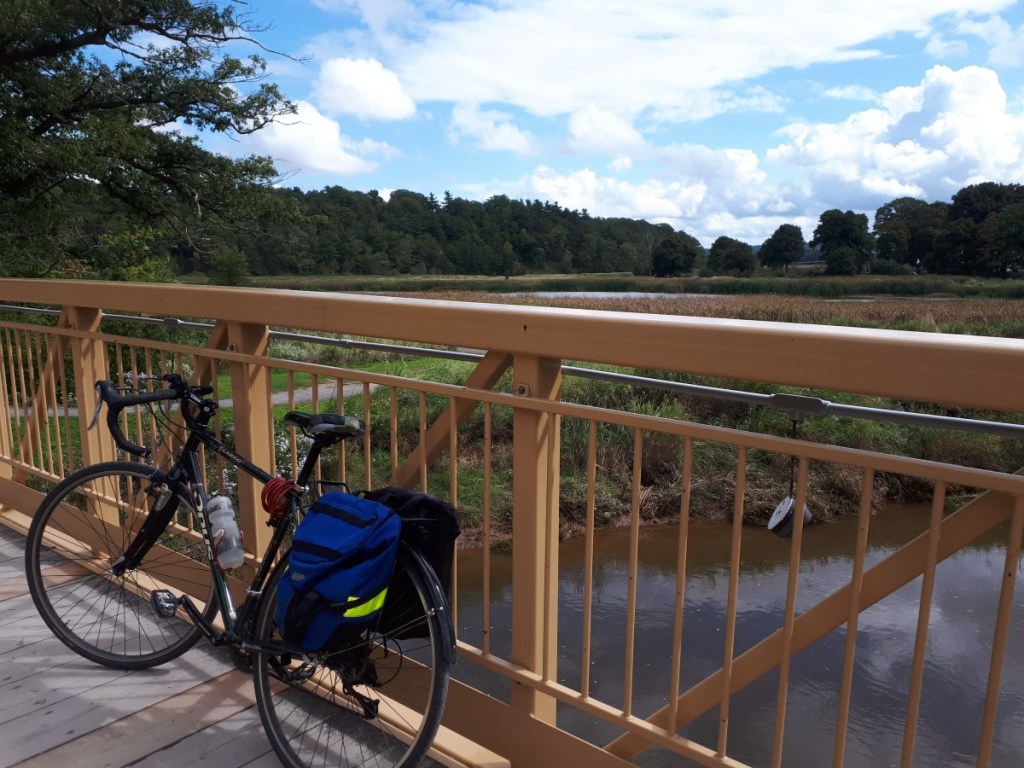
- Kingston to Annapolis Royal (58 km one direction): Poor trail conditions, especially between Bridgetown and Annapolis Royal where it is very sandy! Good for advanced cyclists or people with mountain bikes. Very few amenities (e.g. bathrooms) along this section.
We’ve included a little section on transportation options if you only want to travel in one direction. There are a few to choose from — ranging significantly in price and duration.
Grand Pré to Kentville
It was in September 2021. We booked a night stay in an oTENTik at Grand Pré National Historic Site. Despite the foggy weather in Halifax, we threw our bikes on the car and were rewarded with a (mostly) sunny out and back ride from Grand Pré to Kentville. In total, the trip was about 35 km when we added in a detour to a couple vineyards on the way back.
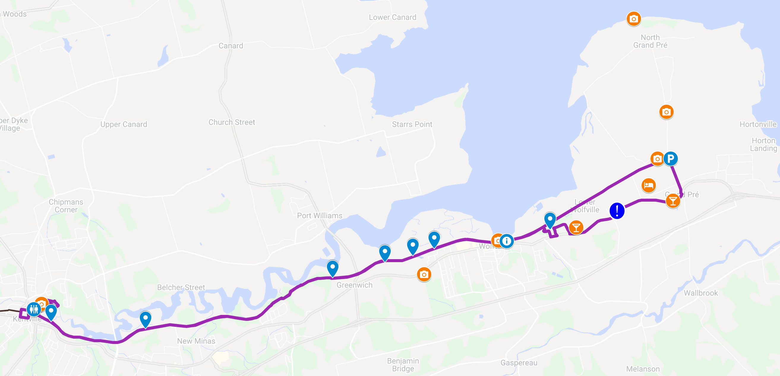
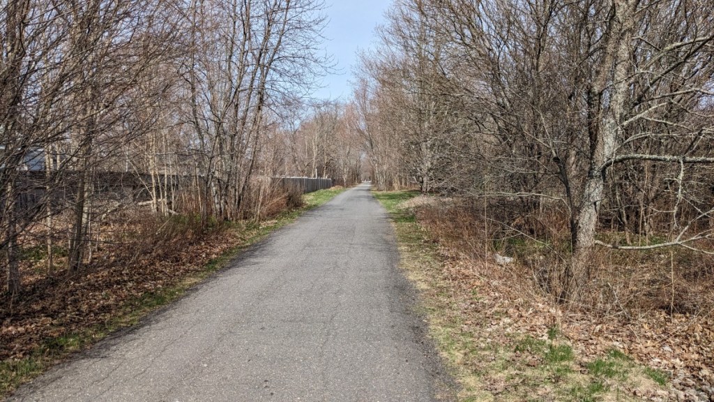
The trail is flat except for one or two small hills in the Greenwich to New Minas segment. The trail crosses a few roads and driveways that were not very busy, with the exception of the Highway 358 crossing in Greenwich where there was a steady stream of fast traffic. The terrain is mostly packed crusher dust, but does vary along the way.
In Wolfville and Greenwich, there are some sections where the gravel is pretty loose. This makes it hard going and slippery.
In New Minas, there are several kilometers of glorious pavement before changing to bumpy gravel near Kentville. At least the variety keeps it interesting!
The landscape consists of forest and fields. There are several nice places to rest and enjoy the view, particularly in Wolfville and Greenwich. After that the trail is mostly in the forest through New Minas and Kentville, but you get occasional glimpses of the Annapolis River.
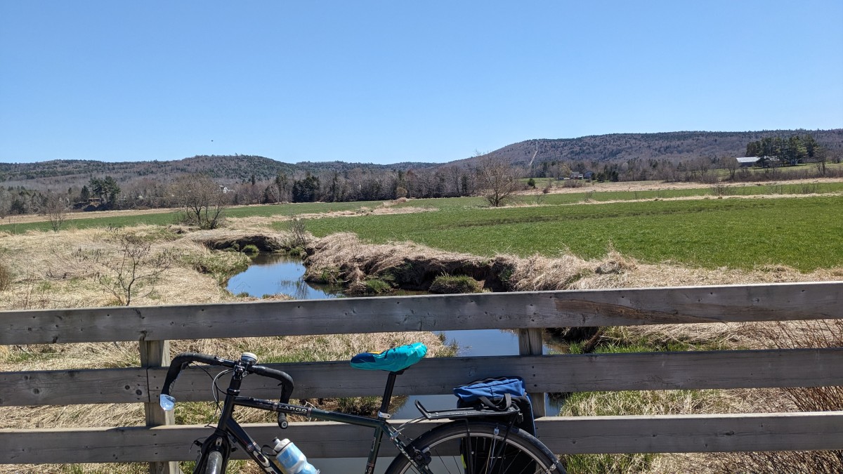
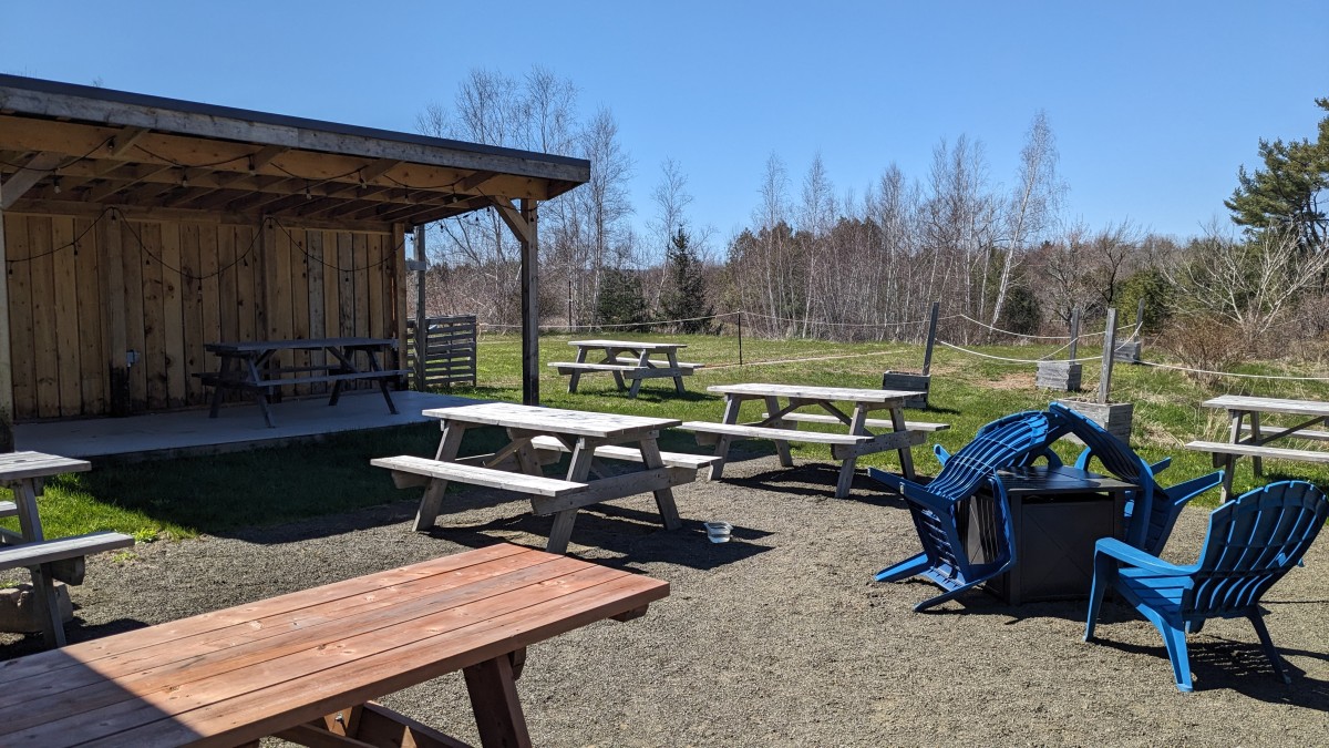
Our stopping point for lunch was the Miner’s Marsh in Kentville. We weren’t planning on going there in particular, but we followed the sign for the picnic table and were pleasantly surprised by this Ducks Unlimited Site. We rode our bikes slowly around the marsh until we found a bench with a view. We saw several photographers taking pictures of the birds in the area and enjoyed watching the tide flow out of the Annapolis River. We were less thrilled by the dark rain clouds that moved in as we finished dessert.
After lunch, we went into Kentville to try to find ice cream, but the skies opened and the rain started streaming down! We contemplated stopping at a pub to see if it would pass, but instead put on our rain gear and headed back towards Grand Pré. Thankfully, we were just at the edge of the storm and managed to stay pretty dry. We can’t say the same for the unfortunate cyclists who were riding in the other direction.
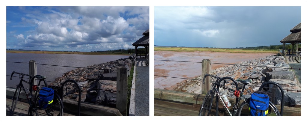
On our way back we stopped at the Wolfville Waterfront again. Justine, being a tidal geek, was quick to point out to Adrien that in the ~3 hour trip, the water level in Wolfville dropped by several meters! He admitted it was pretty cool, but didn’t share in her excitement.
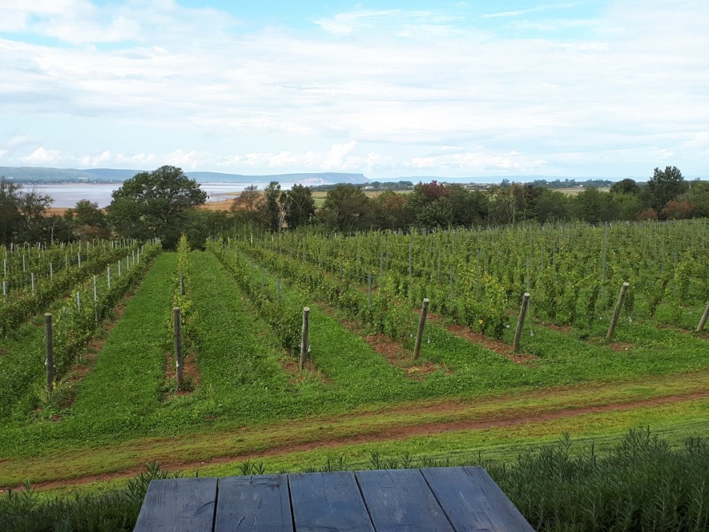
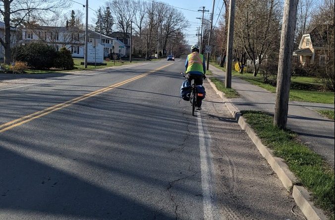
Our ride ended with a detour off the trail to visit two wineries at the edge of Wolfville (Lightfoot & Wolfville Vineyards and Domaine de Grand Pré). On the map, these looked “just off the trail”, but we actually ended up riding on Main St. on a busy Saturday afternoon. It was definitely our least favourite section of the trip but the wine made it worth it!
Some logistical features of the trail that we’ve marked on the map:
- Ample parking just beyond Grand Pré visitor centre on the right hand side of Grand Pré Rd. (just past the trail head).
- There are several access points to the trail, but they are spread out, so if you are planning detours for wine tasting and/or apple picking, you should plan your route carefully. We’ve marked the ones we remember on the map.
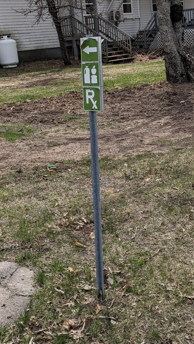
- There is a sign near Noggins Farm in Greenwich for bathrooms, food and picnic tables. We also saw a hay ride if that is the sort of break you are looking for.
- There is a port-a-potty at the entrance to Miner’s Marsh.
- The trail actually goes on the streets through Kentville for a short section. We didn’t see much signage, but recommend following Justice Way to avoid the confusing one-way traffic in Kentville.
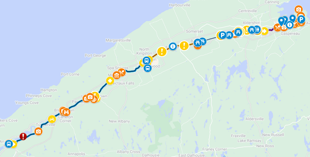
Kentville to Berwick
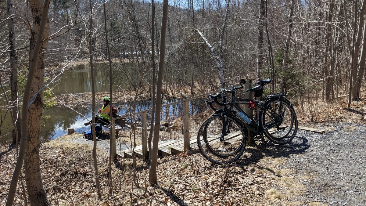
In early April 2023, we did an out and back trip from Kentville to Berwick. It was 20 km in each direction and took us about 3-4 hours, which included a lunch break watching turtles and a beer at the Union Street Pub. We’ve marked all the highlights and warnings on the map. The best trail access is in Kentville, Cambridge Station or Berwick.

The trail conditions were highly variable:
- Downtown Kentville: confusing streets with very little signage!
- Past Memorial Fields: great paved section
- Past Kentville Bird Sanctuary: A section of small loose gravel /sand that was difficult to ride through. It also created a mess of Justine’s chain that took days to clean.
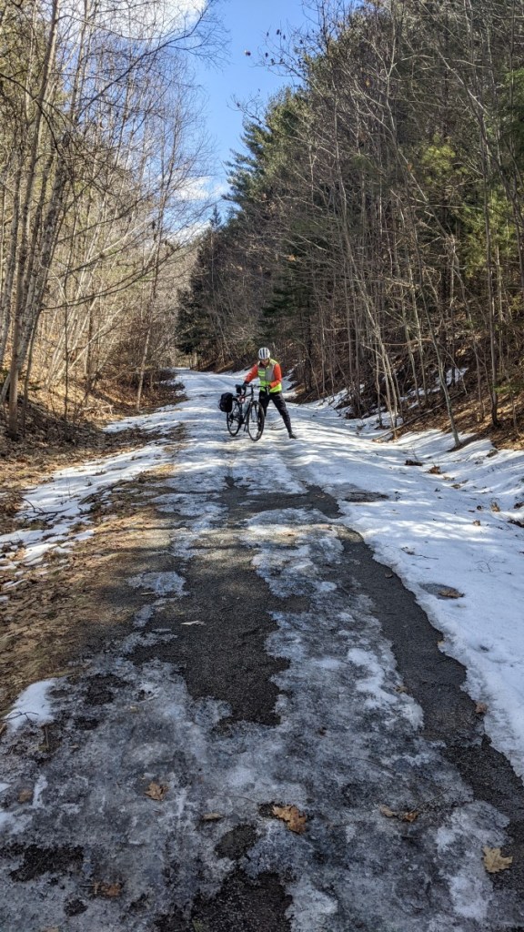
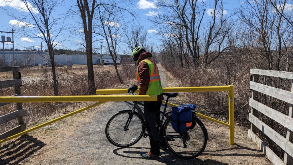
- Kentville Bird Sanctuary to Cambridge Station: Decent section of the trail, but there are some very tight gates that required stopping. These are annoying, but means there are no ATVs! Because it was early April, we also encountered a few snowy / icy sections that we had to cross by foot.
- Cambridge Station to Kentville: The trail became shared usage with ATVs and — as expected — the quality significantly deteriorated. There were lots of potholes and lots of large gravel that is very bumpy to ride on.

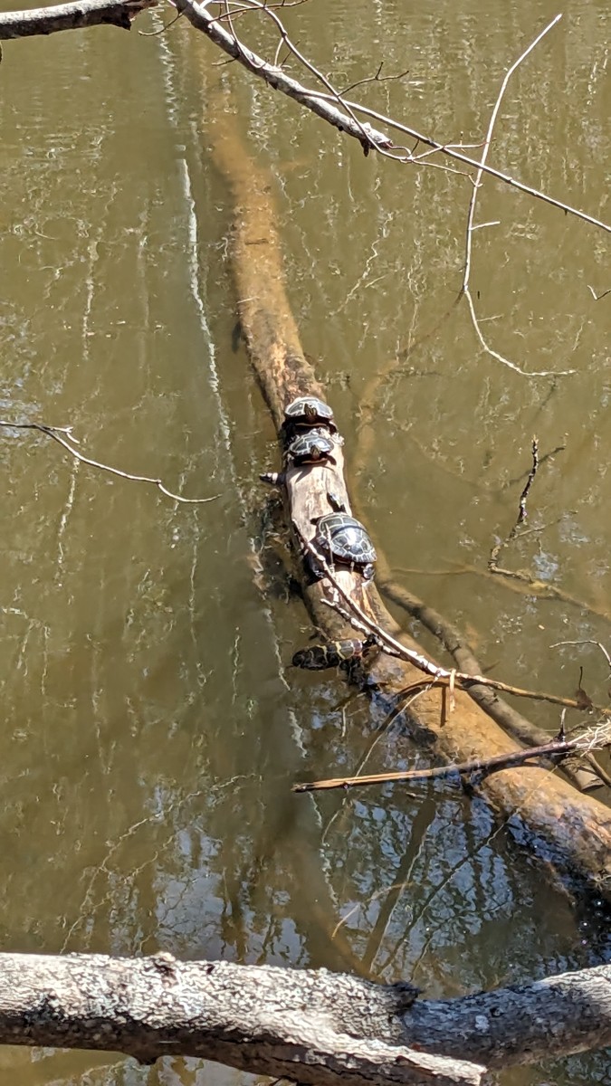
We ended up stopping early in the ride to have some lunch and happened upon EIGHT turtles sunbathing on a log. It was such a treat to see them hop on and off the log.
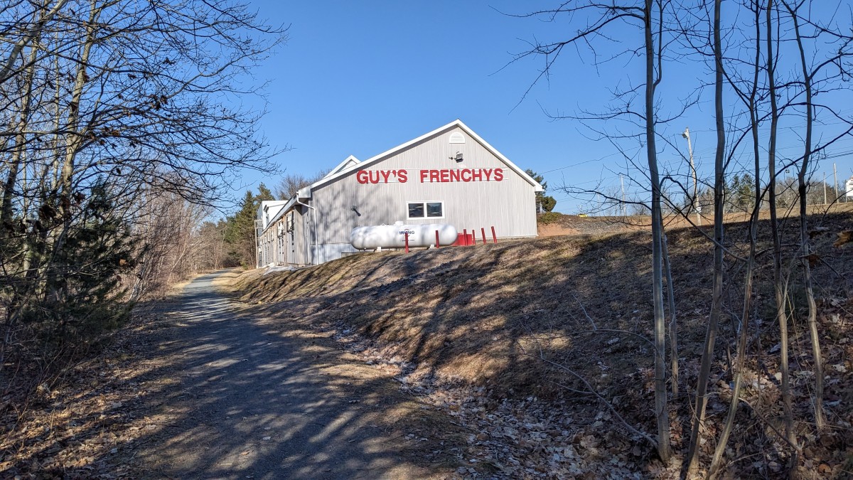
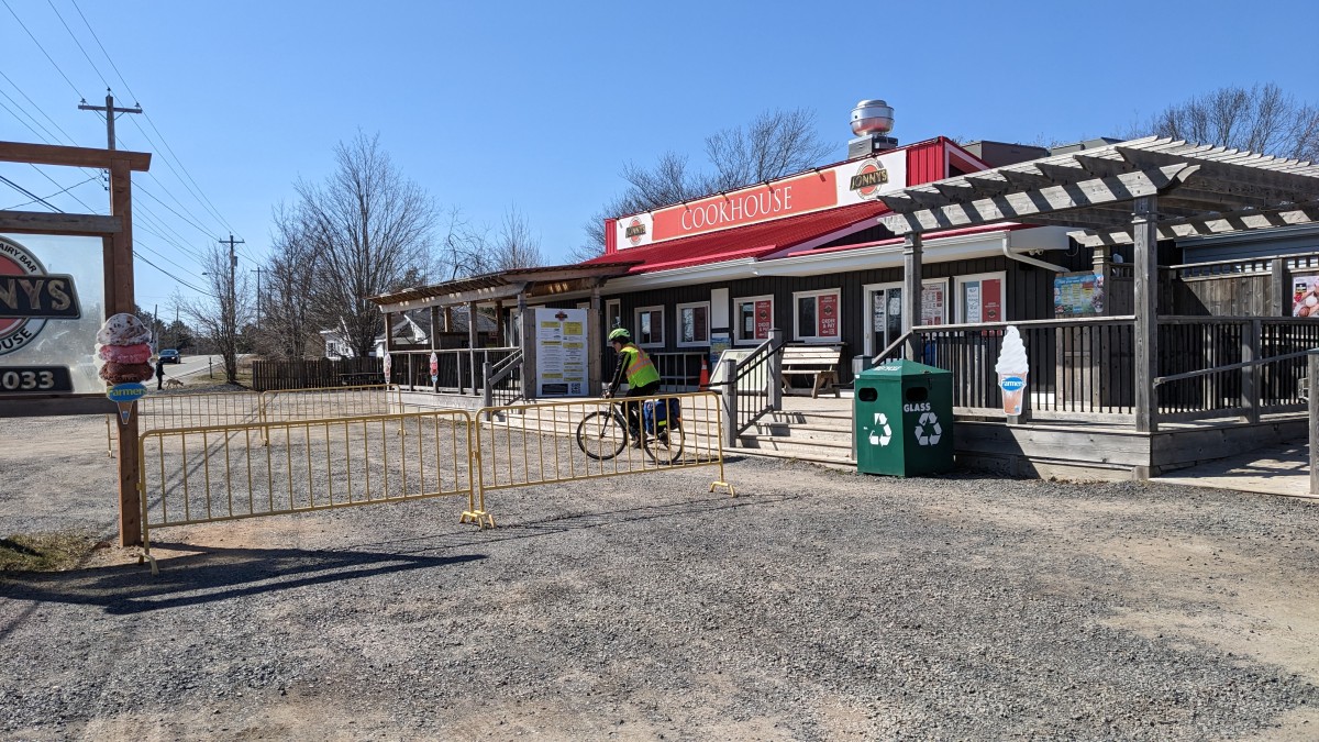
Because we did this ride on Easter Sunday, not much was open. But someday we will go back and visit the Frenchy’s in Coldbrook and/or Berwick. Johnny’s Cookhouse also looks like a great place to get some ice cream or a greasy snack.
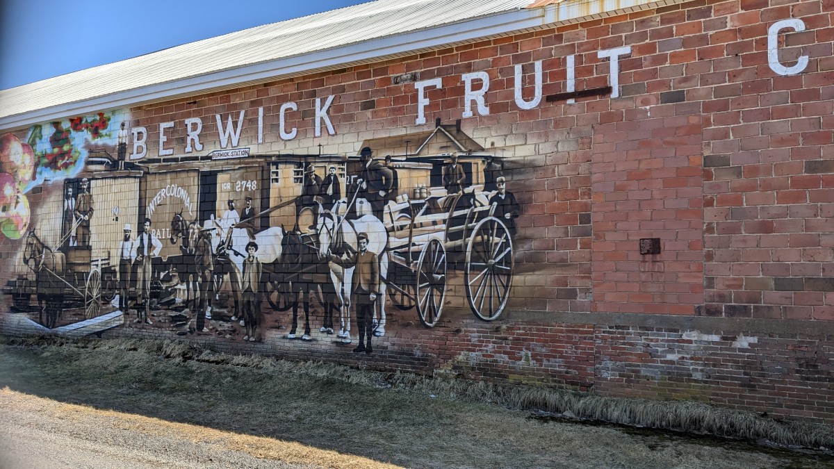
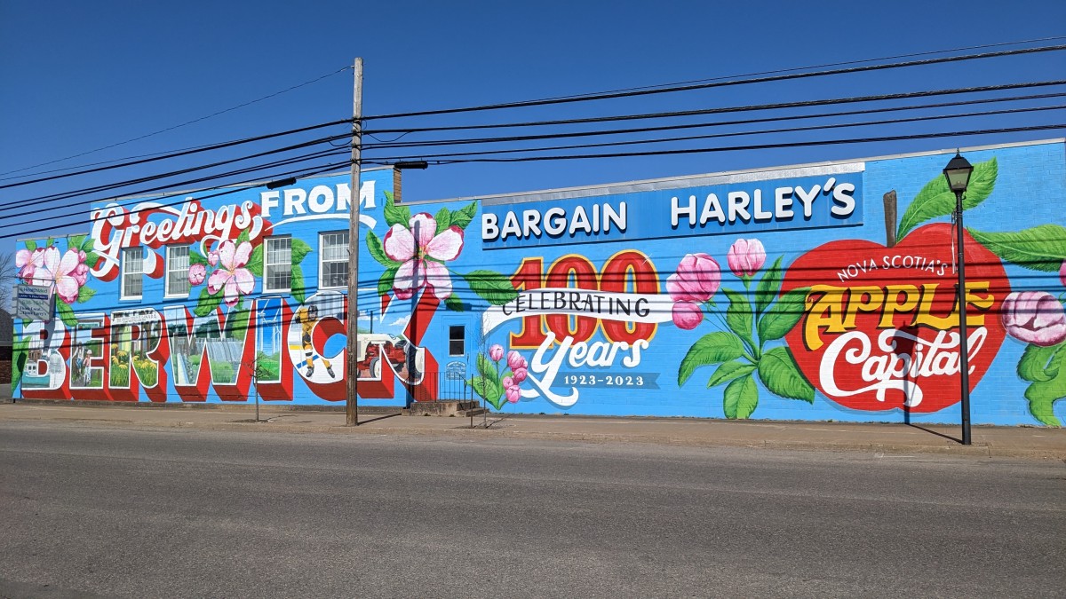
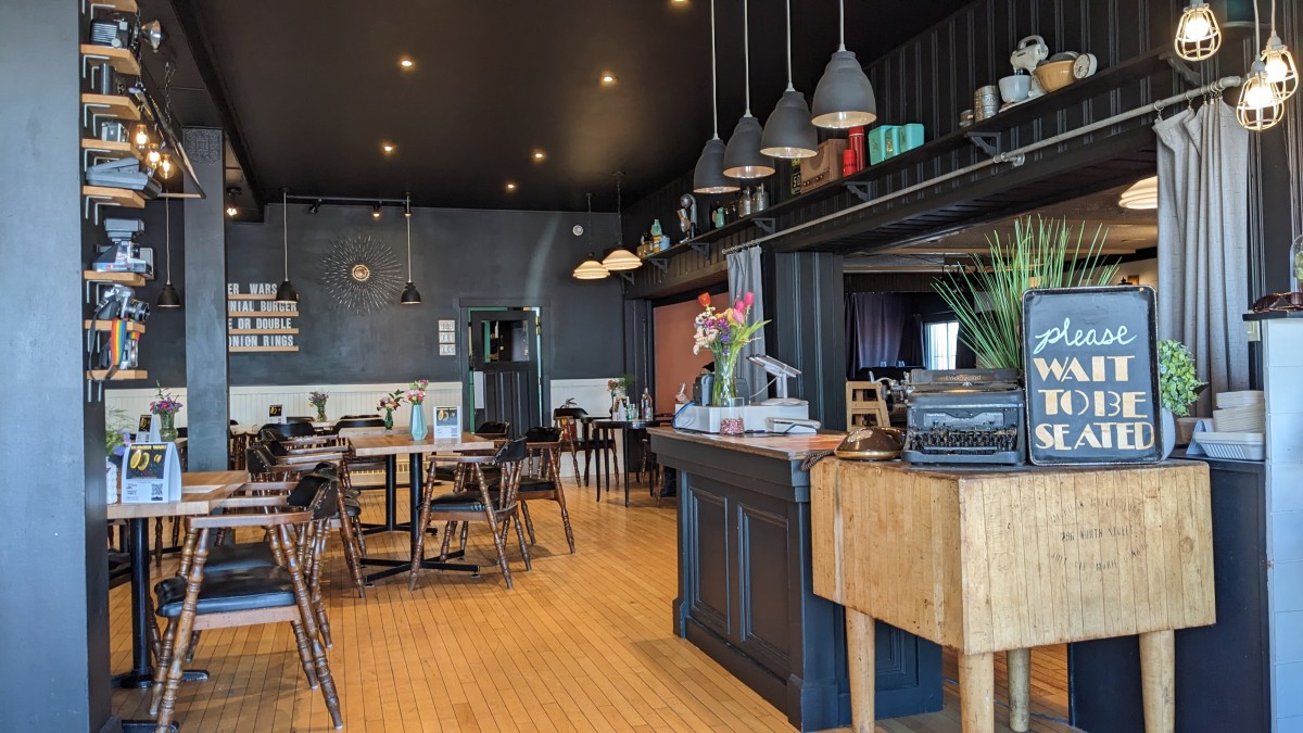
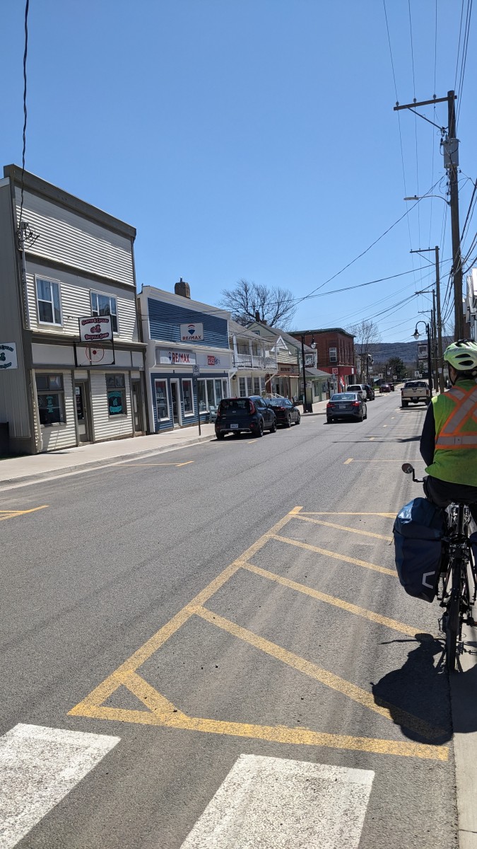
The highlights of Berwick were definitely the incredible murals on the side of buildings and the Union Street Pub. Even though it was quiet when we visited, it felt like a vibrant little community. And, how can you resist a pub with a bike on the wall!
Berwick to Kingston
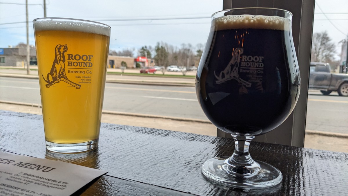
In late April 2023, we did an out and back trip from Berwick to Kingston. It was 18 km in each direction and took us about 3 hours, which included a break at Roof Hound Brewing. We’ve marked all the highlights and warnings on the map. The best trail access is in Berwick, Aylesford or Kingston.

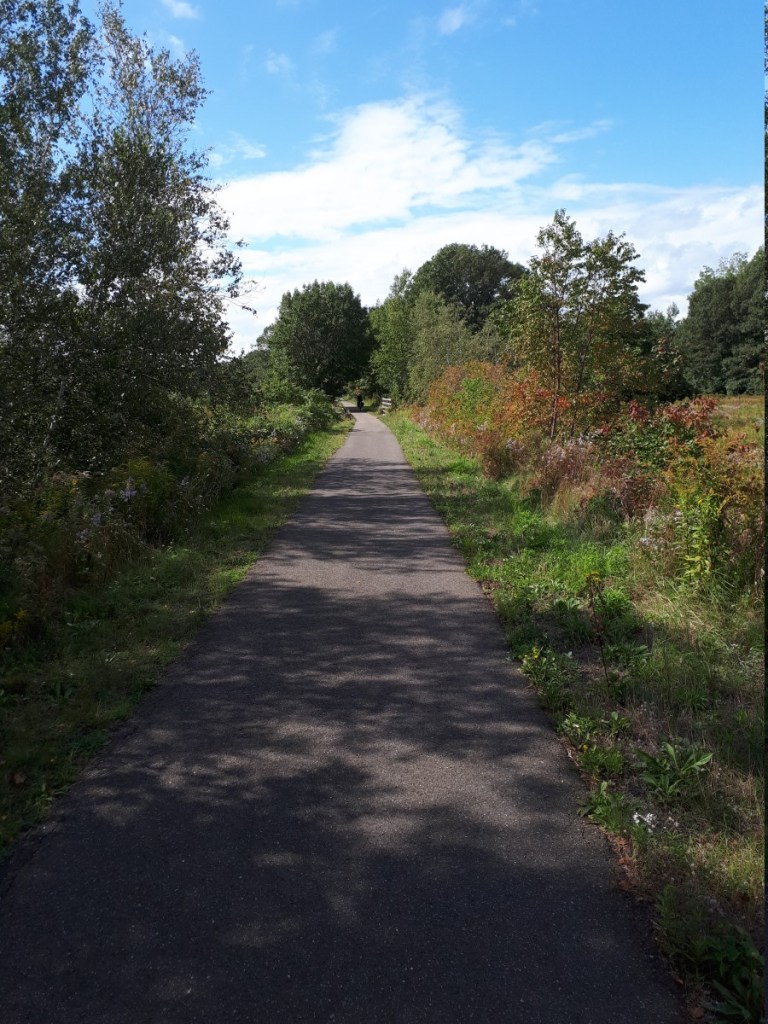
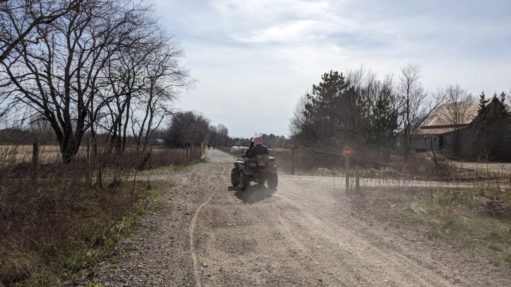
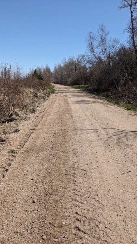
This section of the Harvest Moon Trailway was pretty unremarkable. It was a shared use path, meaning that there were a lot of ATVs and the conditions were bumpy. There were lots of potholes, and big-loose gravel. The trail passes through farmland and forested areas. There is a short paved section within Kingston, but the pavement is almost as bumpy as the gravel! The section is fine to pass through, but we don’t recommend it as a specific destination.

The best part of the trip was definitely the beer at Roof Hound Brewing. We also saw an interesting sign that suggested that there may be some cider available in Aylesford?
Annapolis Royal to Kingston
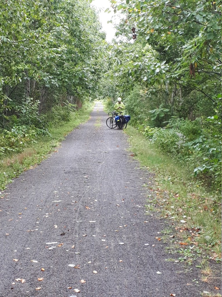
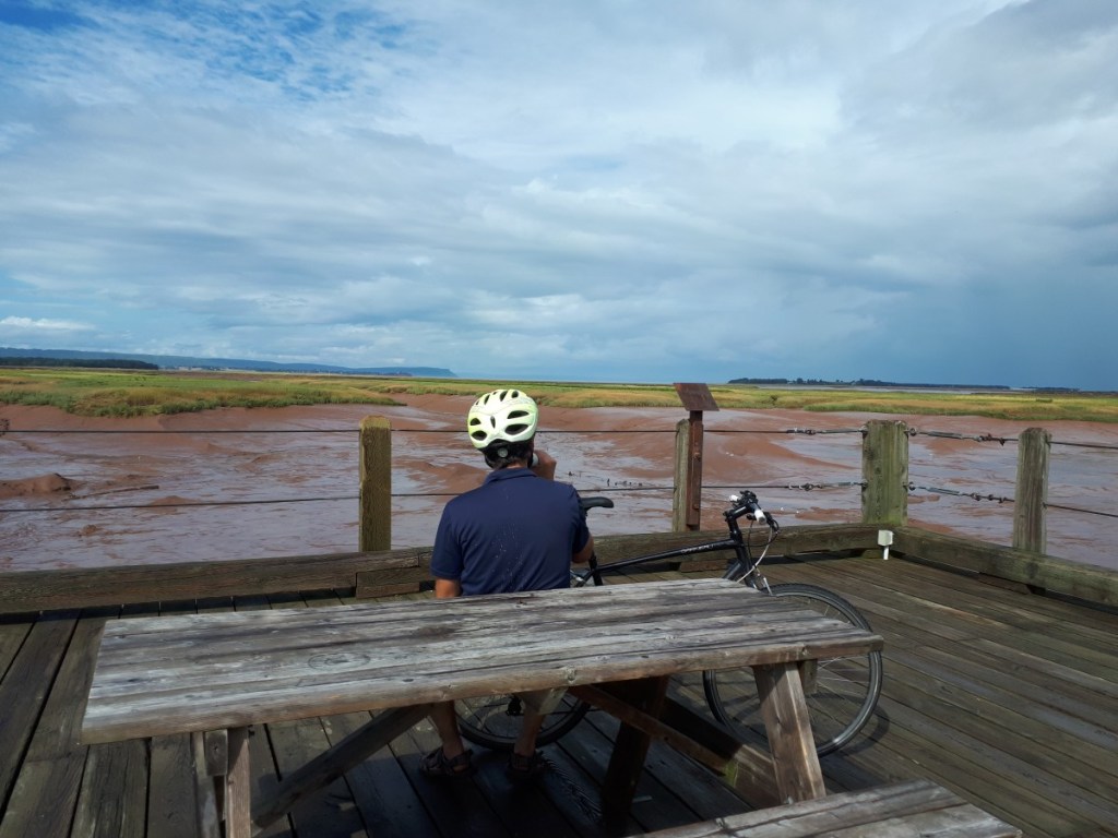
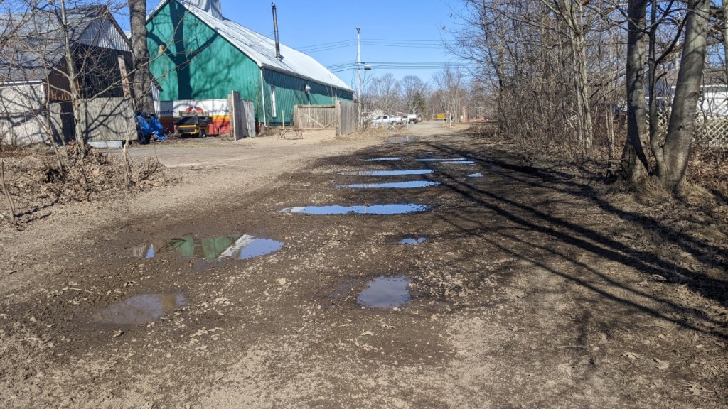
In April 2024, we finally managed to complete the Harvest Moon Trailway! We biked from Annapolis Royal to Kingston and added a few detours, making it 65 km in total. The hardest part wasn’t the distance, but the VERY sandy conditions. We’ve marked all the highlights and warnings on the map. The worst section was definitely Annapolis Royal to Bridgetown, but in reality the whole trip was tough! Thankfully we had read this blog by Wild In Nature and had a warning about the conditions (although it was worse than we expected).
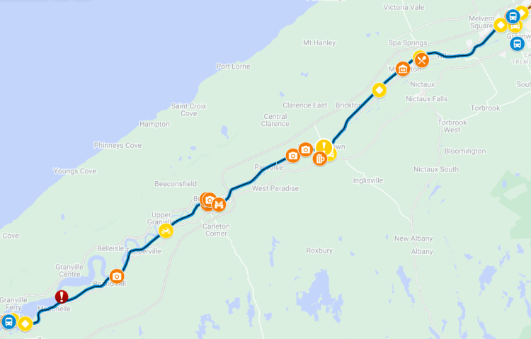
To complete this in one day, we got up very early to drive from Halifax to Kingston. There, we parked the car in front of the Roof Hound Brewing Company (see above) and biked 2.8 km down Bridge Street towards Greenwood to catch the bus at Avery’s Farm Market. The road had a shoulder, but it was covered in gravel and glass.
We loaded our bikes onto the 9 am Kings Transit bus to Bridgetown, where we caught another bus to Annapolis Royal. The total bus ride took around 90 minutes. See Transportation Options (below) for more details.
Once in Annapolis Royal, we had coffee and a treat at Sissiboo Coffee Roaster before hitting the road.
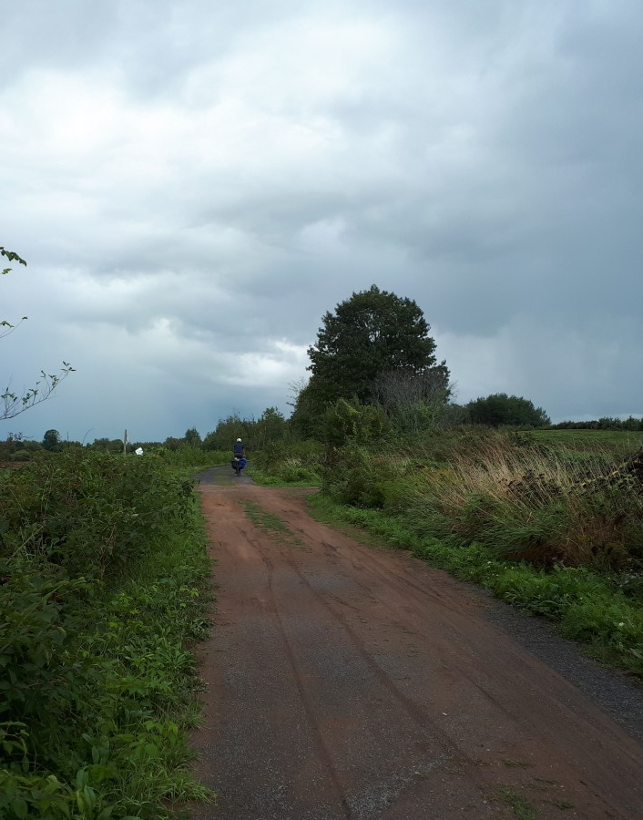
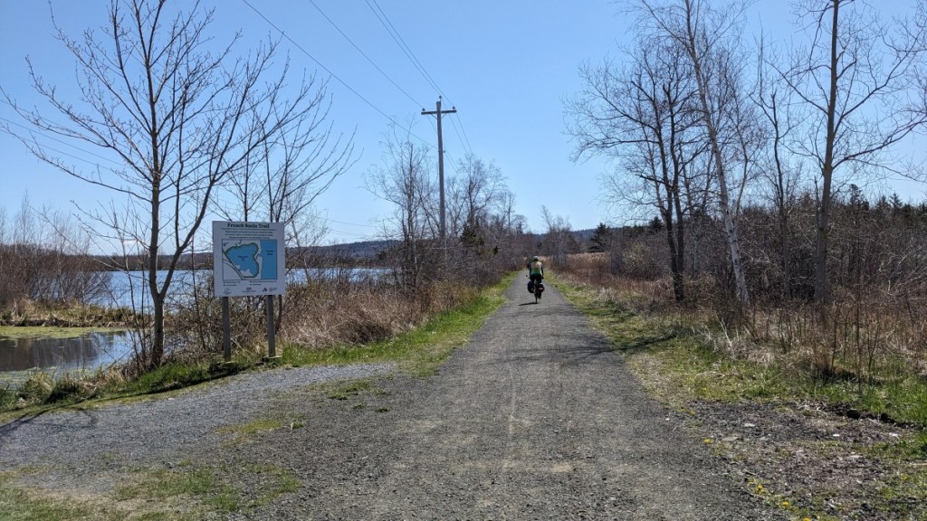
We went on Prince Albert Road that turns into Evangeline Trail until we reached the French Basin Rail Trail that becomes Annapolis County Rail Trail. It was all the same gravel trail, but after less than a kilometer, it suddenly turned into a narrow path in a forested area.
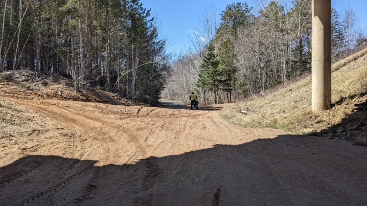
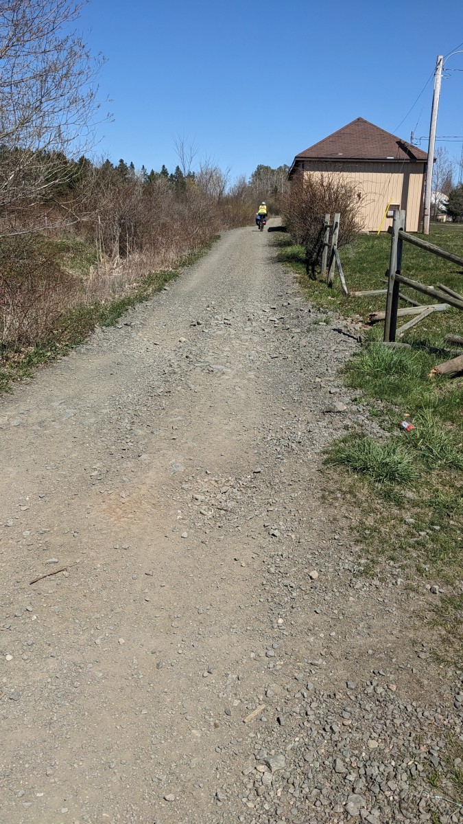
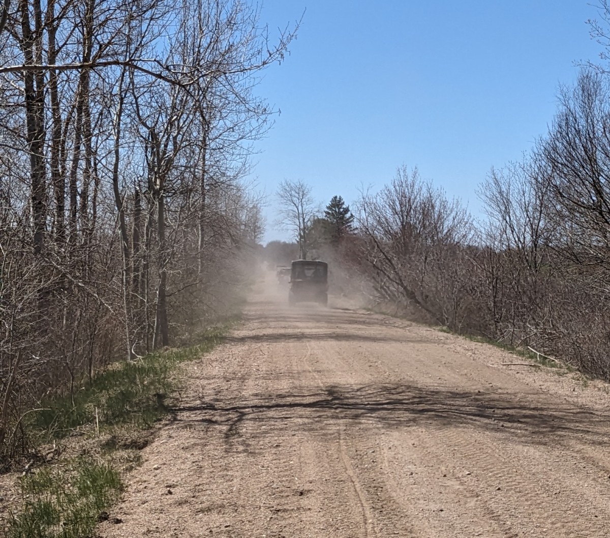
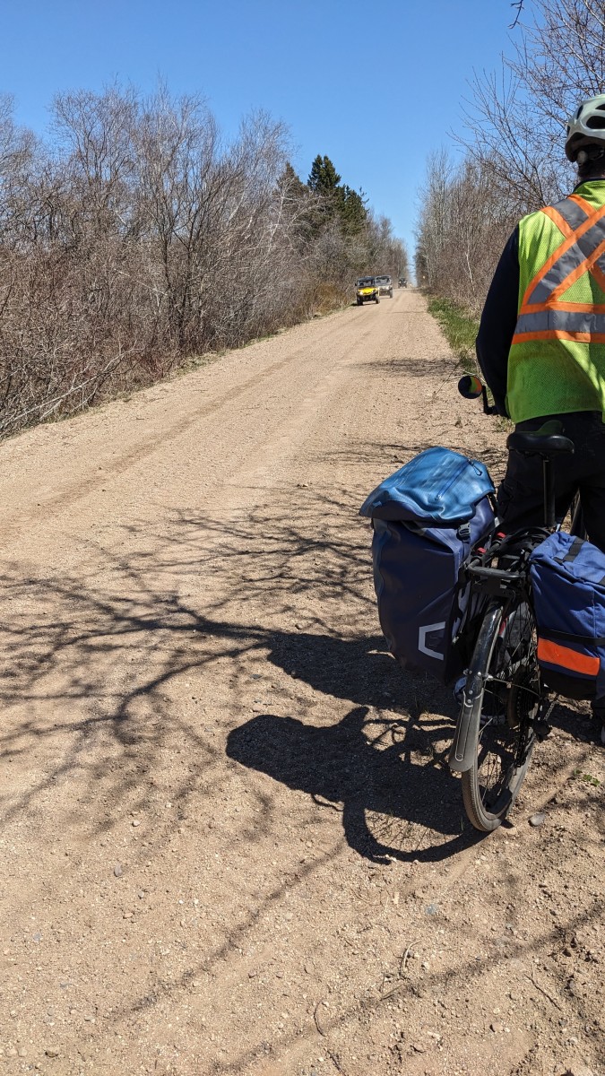
We continued on and eventually reached a wider and VERY sandy part of the trail. The sand was prevalent for the entire 23 km to Bridgetown and was hard to pedal through on our hybrid bikes. The views of the river were beautiful, but our head was down for most of the ride. Our average speed was only 13.8 km/hr, compared to our usual pace of 17-18 km/hr.


We captured a couple videos to try to show just how slippery and bumpy it was. This is NOT what you see when you google “Harvest Moon Trailway You Tube”. Instead you get promotional videos showing smiling people with perfect hair visiting local pubs and taking selfies with cows (e.g. from the Nova Scotia government) . So be warned — it is not as east as it seems! We did find this video from Bent on Bike Trails that gives a much longer version of what it is like to ride the whole trail.
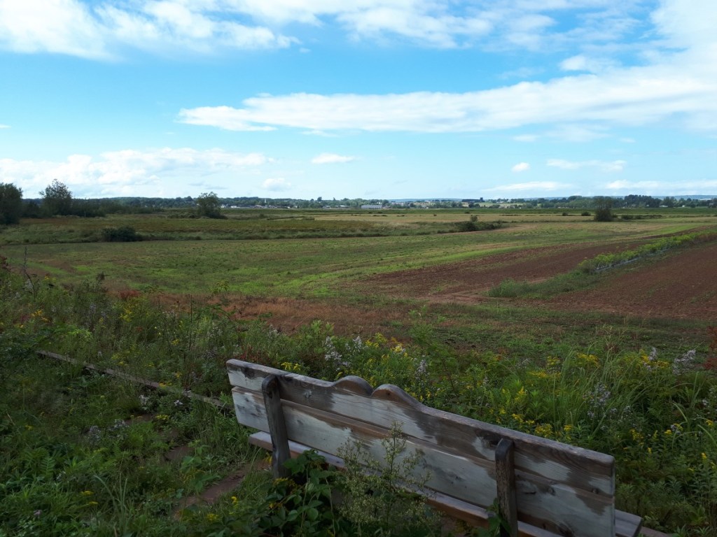
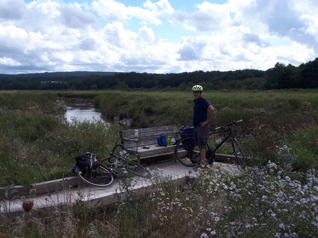
In Bridgetown, we left the trail and headed to Queen Elizabeth II Jubilee Park for a picnic lunch. The park overlooks the Annapolis River and has a picnic area and bathrooms, but they were closed in April. On our way back to the trail we biked through the quaint downtown and spotted The Bridgetown Family Campground right next to the trail.


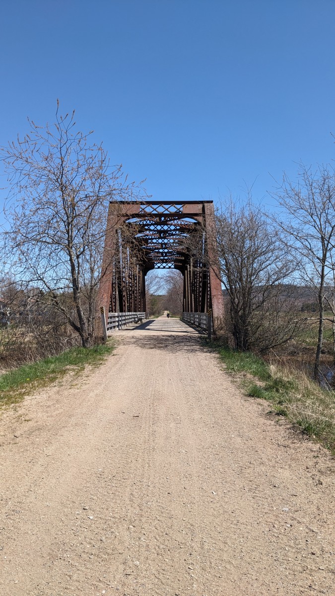
After lunch, we continued eastward on the trail immediately crossing the old railway bridge that appears in all the promotional material about the Harvest Moon Trail. We then passed through Paradise (yes, it’s a real place) enroute to Lawrencetown where we made a 4 km detour to have beer and fries at Lunn’s Mill Beer Company, a somewhat hilly 4 km detour that was worth it. This section of the trail was a little less sandy, but our average speed was still only 14.1 km/hr, so it wasn’t great! And the short section in Lawrencetown itself was riddled with rocks.


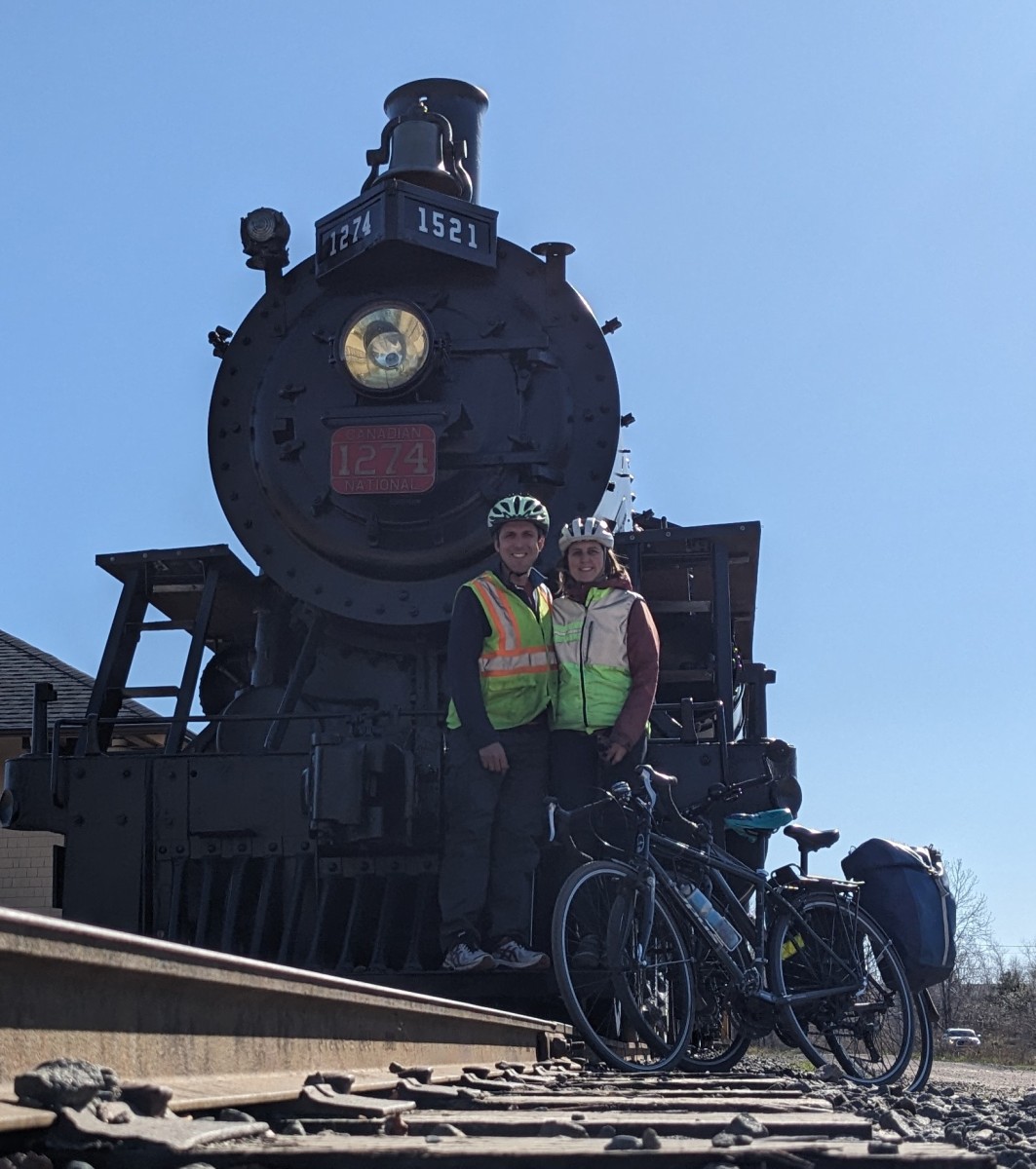
After leaving the brewery, we headed back to the trail with the goal of ice cream as our next break. We passed through Middleton and checked out the steam engine train that is part of the Middleton Railway Museum. At this point we were very tired and really wished that the train was still operational! But we took a break, took a selfie with the train and our bikes. We didn’t go into Middleton, but there are lots of services there if you needed to stop. Instead, we continued to the Big Scoop which is just east of the town, and a very quick detour off the trail. They had both soft serve and hard ice cream making us both happy — and the view of the winding river was great!


The sugar from the ice cream and the slightly better trail conditions (less sandy, but pretty bumpy) helped us through the final 10 km. The trail became paved just west of Kingston, but even that was still bumpy! We arrived back at our Communauto car around 6 pm, after catching the bus at 9am. So a long day that we celebrated at the Union Street Pub in Berwick. Their food is delicious and their decor is perfect for this kind of trip.
In total we biked 65 km in 4.5 hours. We were passed by 33 ATVs, 2 dirt bikes and 2 bicycles. We had a great day, but the trail conditions west of Middleton are so challenging that we don’t think we will do this again for awhile. We are hoping that the communities and the Blue Route make investments to improve this promoted cycling route that could be so so much better. The scenery is beautiful, but the trail is not.
Transportation Options
It would be ideal to do the trail, or segments of it, in one direction allowing you to see as many communities as possible. This means that you have to somehow get back to your car. Unfortunately, you can’t hop on a train like we did for the Canal de Garonne, but we’ve found a few options.
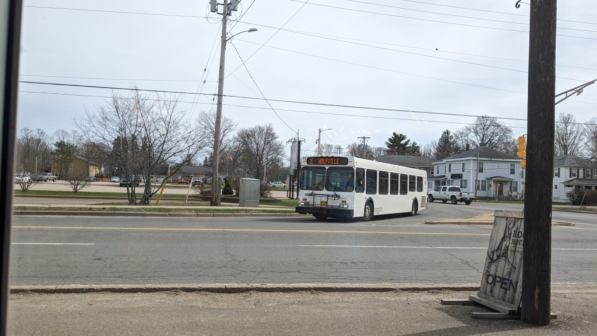
- Kings Transit: A public bus with bike racks that runs the entire length of the valley. The fare is only $4/person, but it would takes 4+ hours to go 100km. And the buses don’t run on Sundays or holidays. So, not the most convenient option, but a good one if you are on a budget and/or you need some emergency transportation. It has a cool map where you can track your bus and the schedules are coordinated so you can hop off a bus and hop on the next one to continue your journey without waiting too long. We took the bus from Kingston to Annapolis Royal when we did the western section of the trail. It was great! It arrived on time, we made a connection in Bridgetown and the 1.5 hours flew by because we enjoyed views of the communities that you don’t see from the trail.
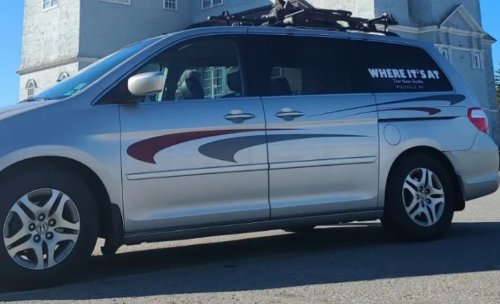
- Where It’s At: A tour company based in Wolfville that offers private shuttles for you and your bike. The price is $250 for the first 200 km, and $1.15/km thereafter, making it about $273 total for the end-to-end transportation for the Harvest Moon Trailway. The price includes up to 4 people and would be only $20 more for a 5th and 6th guest. Booking can be done by reaching out to them on their website.
- Taxi: There are several taxi companies in the valley that could be used. They wouldn’t transport bikes, but could transport you back to your car. We reached out to CJ’s taxi and M&G cab and they both quoted us about $200 for a 100km trip.

One thought on “Harvest Moon Trailway”