
On Easter long weekend 2025, we explored the Fundy Trail Provincial Park in a peculiar way: by bicycle, while the park was closed. In total, we biked 40.6 km with 890 m of elevation. The steepest hill was a 17% gradient and it was definitely a test for our legs. But the views and peacefulness were amazing!
Accessing the park
The park is closed to drivers over the winter, between late October until May long weekend. We were curious if we were still allowed to bike the road so we reached out to their Facebook page. We were told that walkers and cyclists were permitted throughout the year, but they would have to park outside the gate.
We spent the night before in an OTENTik at Fundy National Park. So, to access the park, we drove 50 km, via Shebody Rd, to the eastern entrance of Fundy Trail Provincial Park. We parked on Big Salmon River Rd near the gate. The sign on the gate explicitly says that you are “entering at your own risk”. There wasn’t much room on either side of the gate to maneuver our bikes, so we went under it. This would be more difficult, but doable, with a heavier e-Bike.

Highs and lows
From there, we headed southward towards the Bay of Fundy. The first 8km were downhill but pretty boring through the forest. It was also eerily quiet. We saw three deer right away and wondered what other animals we might see along the way! The possibility of bears was real, but thankfully we didn’t see any!
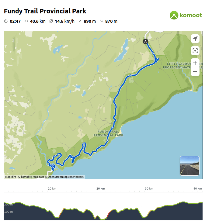
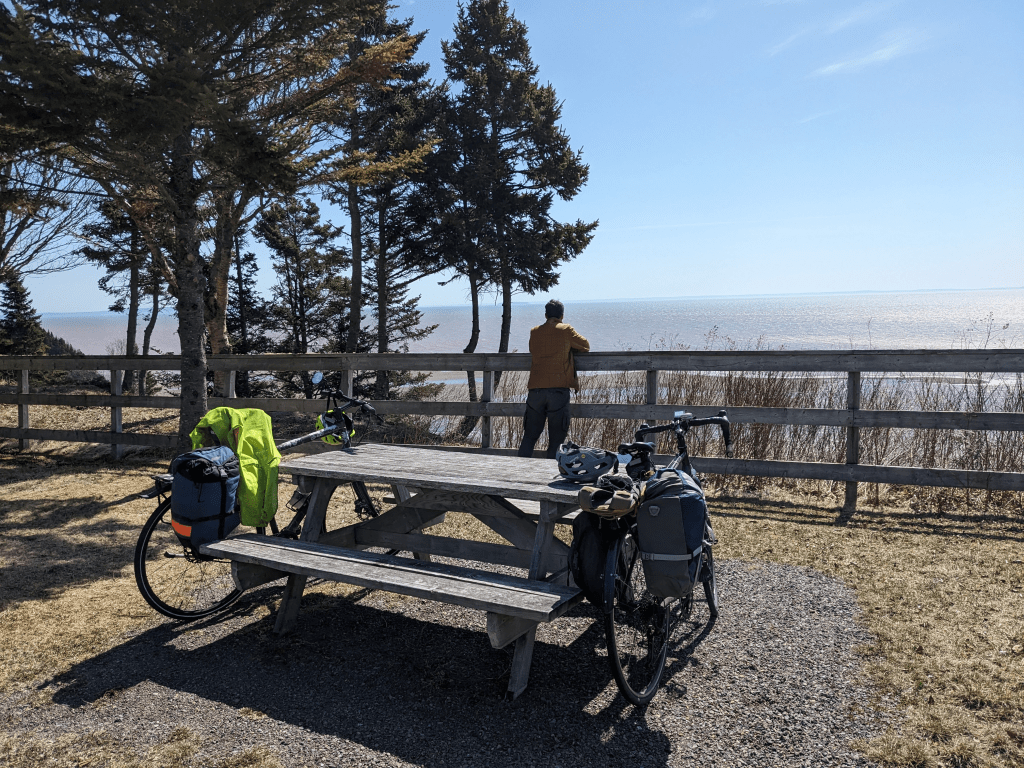
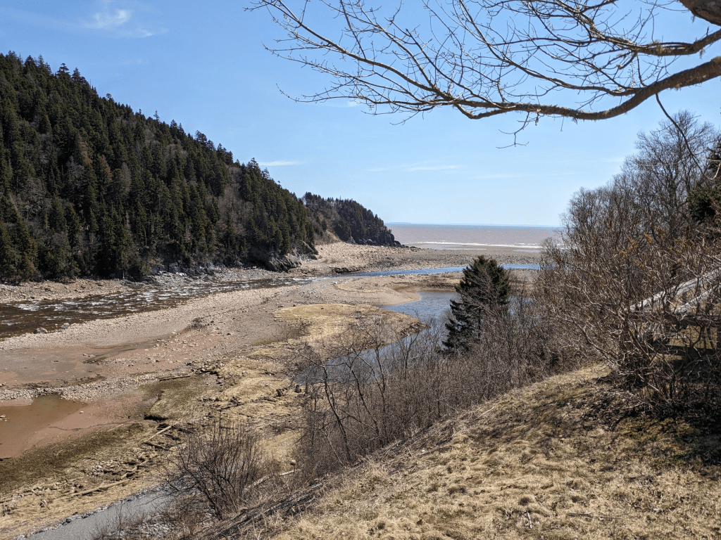
Once we got to the coast, the view points appeared, and so did the hills! It started with 8%, then 12%, and eventually there was a 16%! Going down was fun, but going up required us to do switchbacks. Good thing there were no cars around!

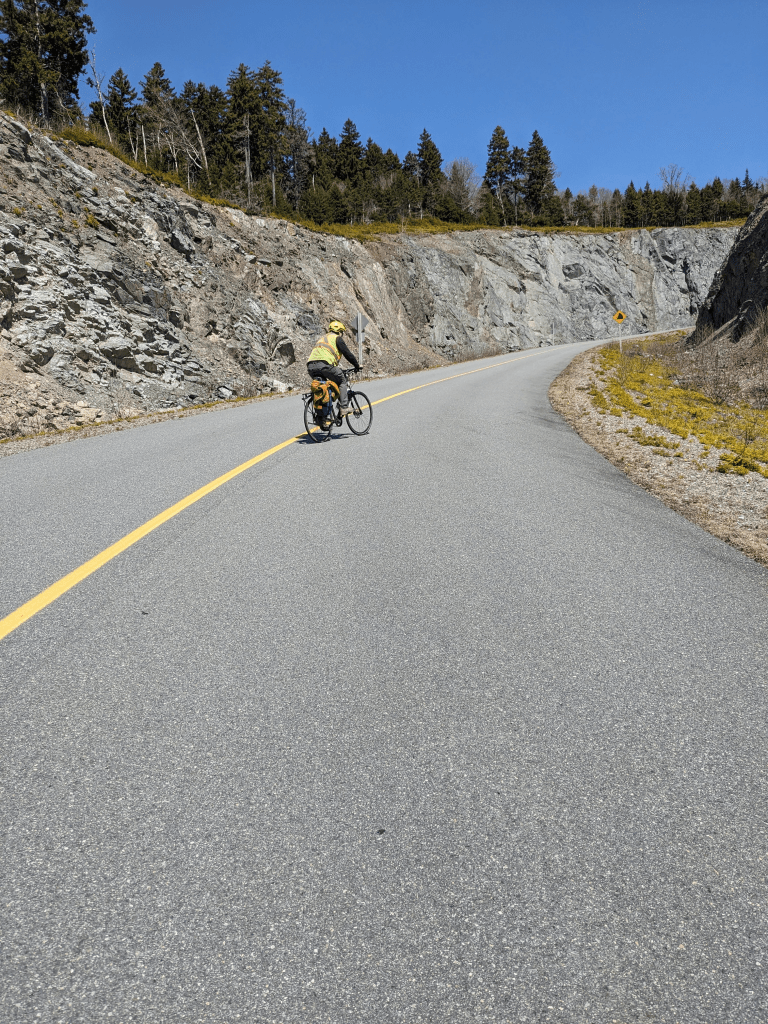
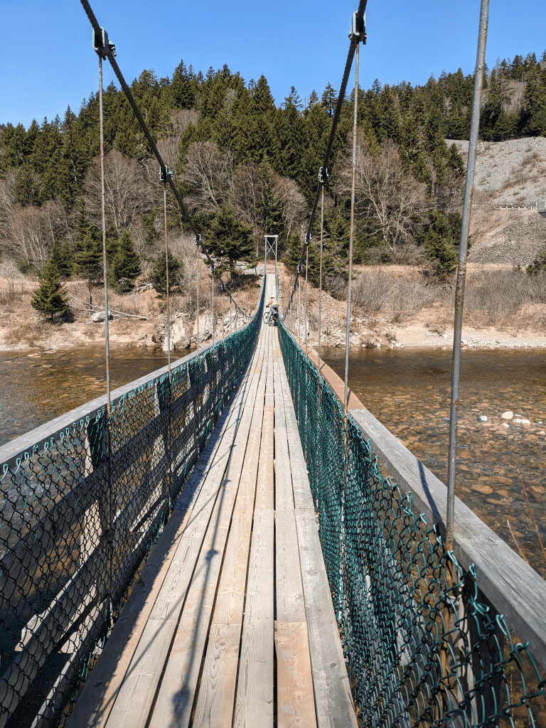
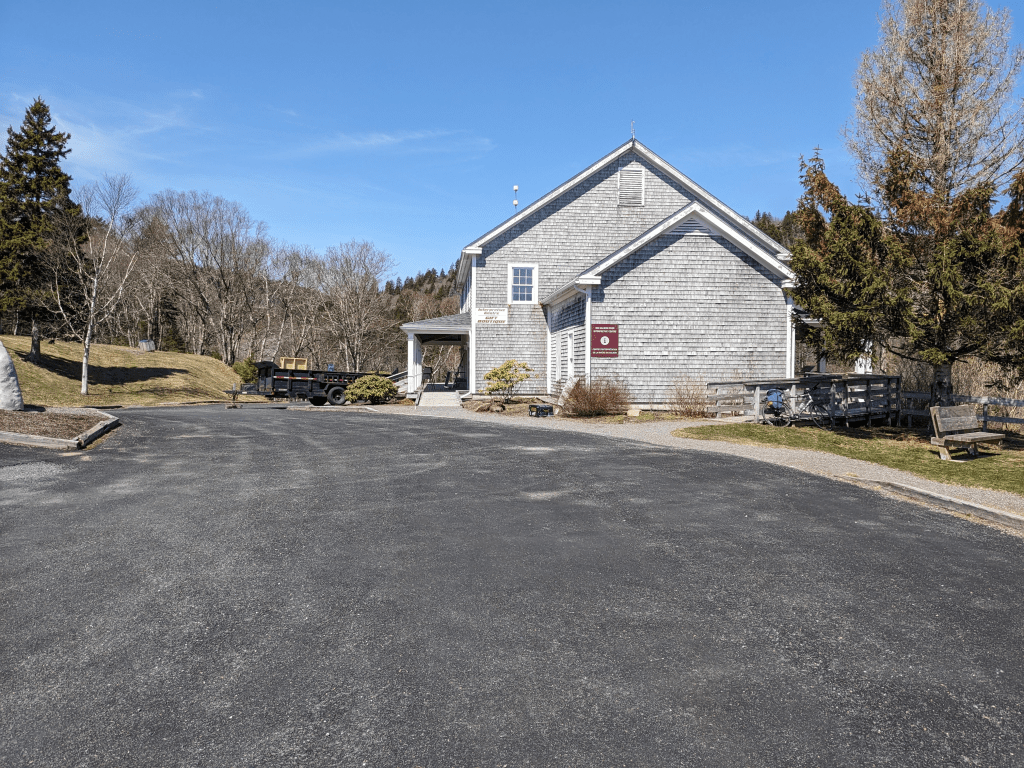
We stopped for a lunch break at Big Salmon River. Once we were refueled, we explored the area around the Visitor Center and checked out the suspension bridge. It was a beautiful region that is likely packed with tourists in the summer. At this point we decided to turn around and head back to the car. The road continued eastward for another 10km, and it would have likely been beautiful, but we knew we had some big hills to climb on the way back.

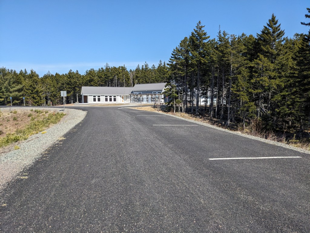
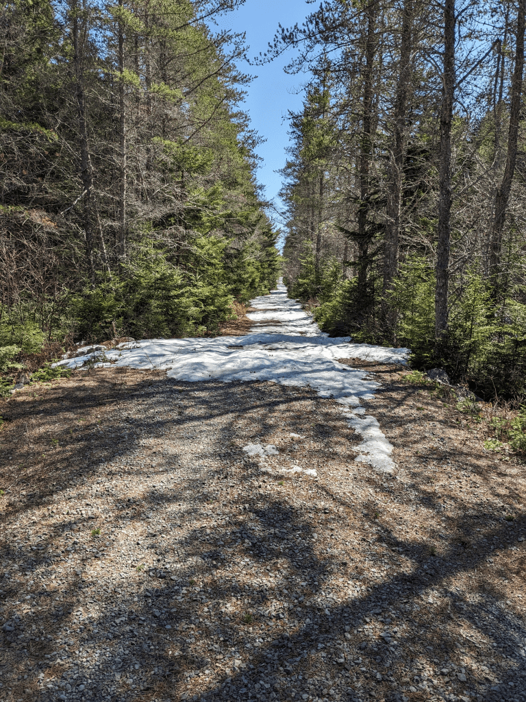
On the way back, we swung by the Walton Glen Reception Centre. It was obviously closed, but we still had a bit of energy left, so we thought we would try one of the “multi-use trails”. Apparently it goes down to a beautiful gorge, but we encountered thick snow pretty quickly, so turned around and decided to call it a day.
Peace and Quiet, and Anxiety
Having this beautiful road almost to ourselves was definitely an unforgettable experience. No cars = less danger + no noise.
On the way in, we felt so isolated from the rest of the world that we were a little anxious. What if we encountered a bear? What if one of us fell and couldn’t bike back to the car? There was little to no cell service, so we were literally on our own!
On the way back, though, after seeing two other cyclists go by, we were able to relax a bit more and truly enjoy the ride. We also knew what to expect for the hills.
It is definitely an experience that we want to relive. But next time we want to do it with friends – so who is free next April or May?!?
Bonus Car-Free Ride: Fundy National Park
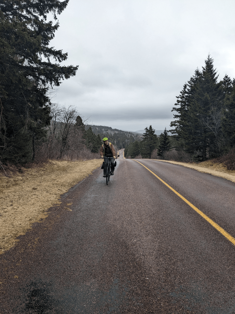
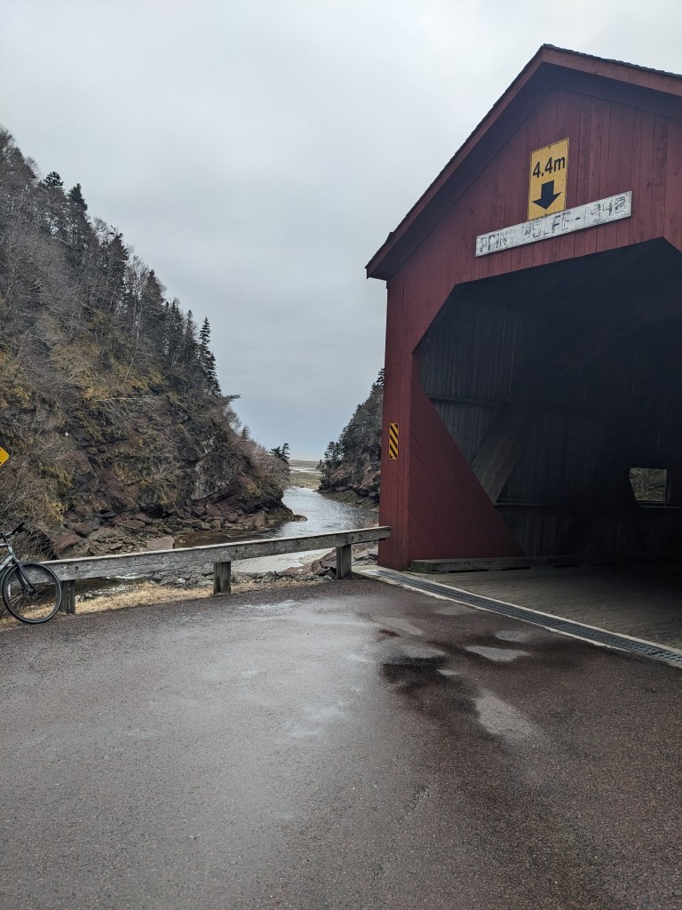
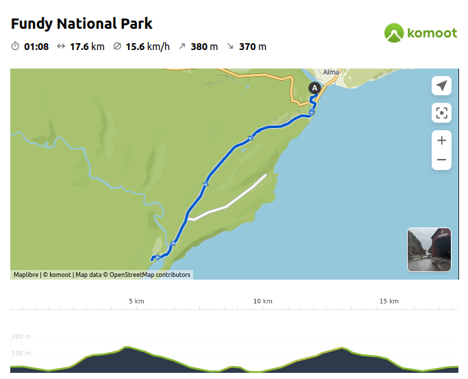
The next day the forecast was calling for rain for most of the afternoon so we decided to squeeze in a ride before checking out of our Otentik. We decided to ride towards Point Wolfe Campground. We were pleasantly surprised to see the road gated off again, so we had another fun, hilly car-free ride. It was shorter at 17.6km and had just one hill! It was steep and long, and our legs were tired, but our reward was a beautiful red covered bridge with the Bay of Fundy in the back.

2 thoughts on “The Fundy Trail Parkway by bicycle”