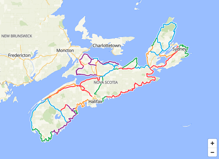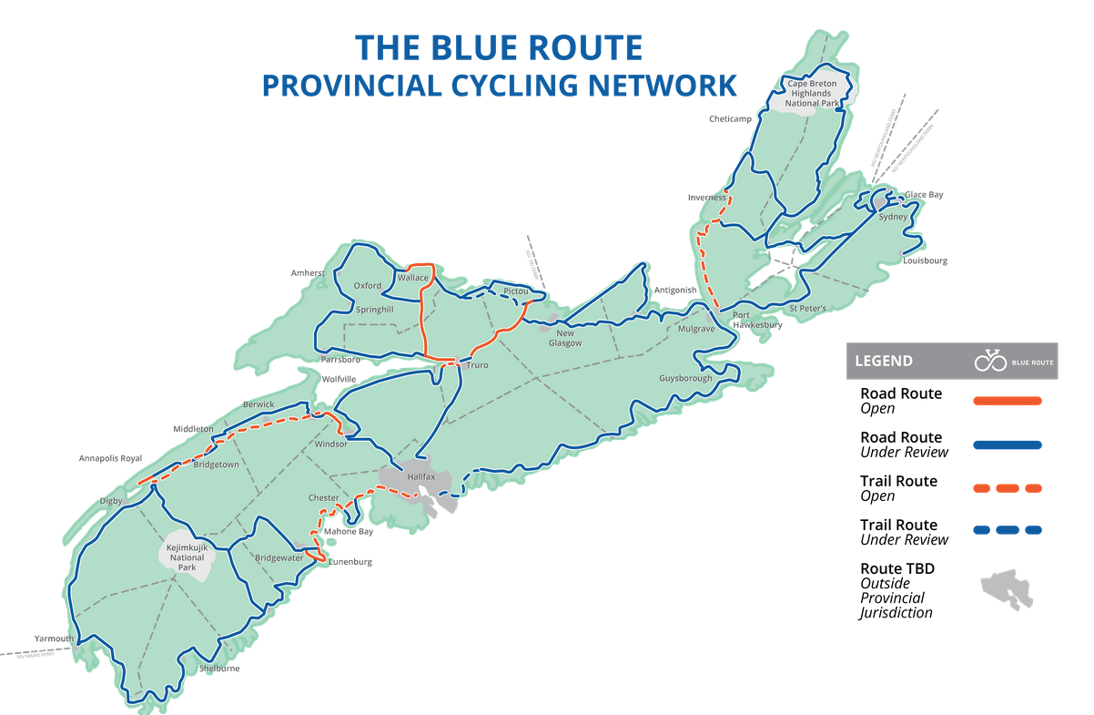
The Blue Route is a provincial cycling network in Nova Scotia that is under development. It aims to be a “continuous, comfortable, convenient cycling route network”. The map available at blueroute.ca/interactive-blue-route-map is not detailed enough to allow for easy route finding, so we’ve done our best effort to recreate the segments in common cycling applications.
This is a work in progress – we hope to finish mapping all the routes soon.
WARNING: Many of these roads are “shared” and offer no specific cycling infrastructure. We’ve tried to highlight trails and paved shoulders where possible.
We will also highlight sections that we’ve ridden and our experiences. Happy to crowd source some of this info, so if you’ve cycled any of the Blue Route segments, please reach out and share your experiences!
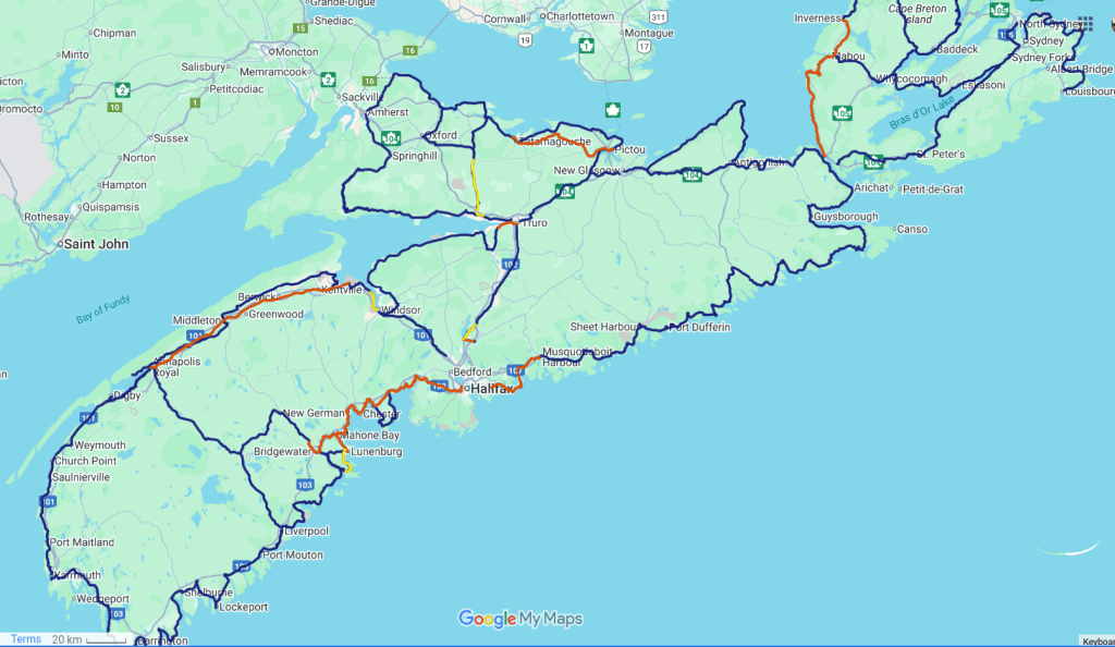
Google MyMaps
An overview of the various segments highlighting trails and paved shoulders. Trail sections are in red and paved shoulders are in yellow. Note: it is very difficult to find information on paved shoulders, so if I’ve missed some, please let me know.
Komoot
We’ve created a collection with downloadable GPS tracks in Komoot. You should be able to navigate and download the segments without an account.
https://www.komoot.com/collection/3835318/-blue-route-nova-scotia
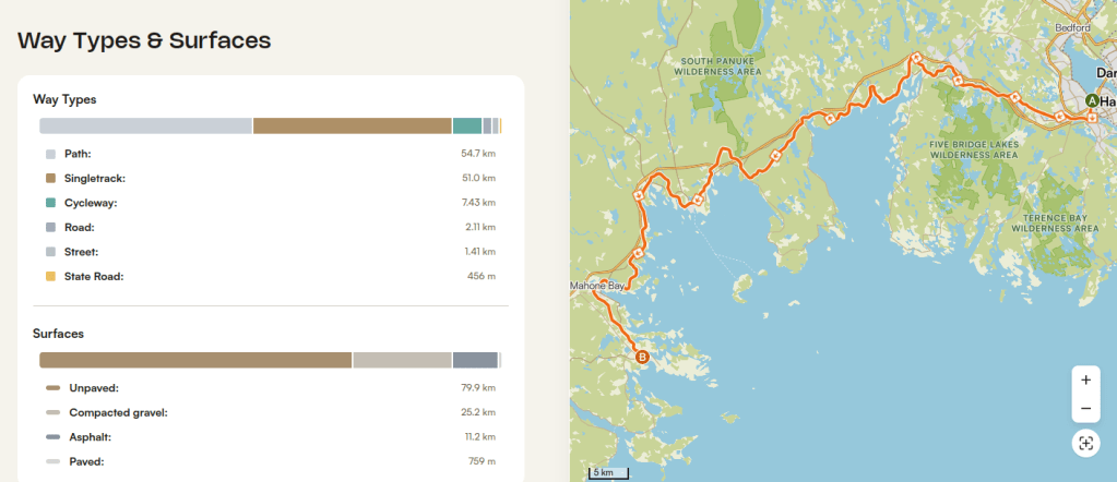
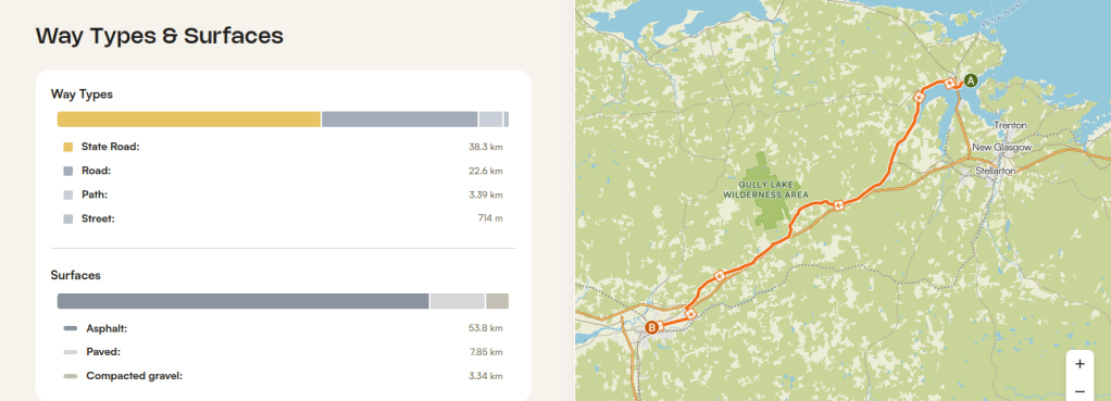
If you do create an account, you will be able to see more specific details about each of the routes. For example, you can see the waytypes and surfaces. It is one of the reasons we love this application for planning trips. It is very popular in Europe and slowly gaining traction in North America.
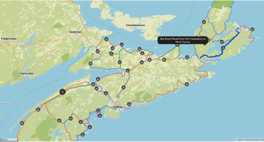
Ride With GPS
We’ve also added the GPS tracks to Ride With GPS. Similar to Komoot, the tracks can be downloaded or explored using this application.
https://ridewithgps.com/collections/8023260